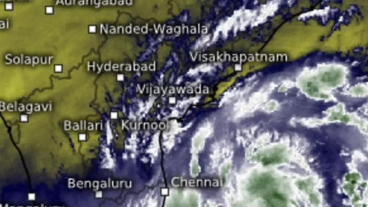
The IMD outlook for the next few days continued to indicate isolated heavy to very heavy rain for Tamil Nadu on Tuesday and Wednesday.
The low-pressure area over central parts of south Bay of Bengal has moved west-northwest during Monday night and lay early on Tuesday morning over south-west Bay of Bengal. It is likely to become ‘more marked’ in a first round of slight intensification and move towards Tamil Nadu coast during subsequent two days.
An incoming western disturbance in the form of a weather-making trough, which is thought to influence the lateral movement of the ‘low’ over south-west Bay, was located over south-central Pakistan. Its southern flanks toyed with Karachi-Mirpur Khas belt that put in line for a tryst with extreme south-west Rajasthan.
‘Low’ may get blown away
The ‘low’ may not have the strength to fend off stronger westerlies blowing at higher levels from the opposite direction, and is likely to give in to them. This may lead it to drift away from the Chennai and Andhra Pradesh coast to east-northeast towards Odisha and West Bengal.
Numerical model predictions of IMD appear to agree with this outlook. But before its gets pulled away from coast in this manner, the ‘low’ is forecast to slow down, or even idle, over the waters off Chennai and south coastal Andhra Pradesh coasts and bring heavy to very heavy rain for the region.
Rain for Tamil Nadu
The IMD outlook for the next few days continued to indicate isolated heavy to very heavy rain for Tamil Nadu today and tomorrow (Tuesday and Wednesday). Isolated heavy rain is likely on Thursday. Over coastal Andhra Pradesh and Rayalaseema, it would be isolated heavy for three days from Tuesday.
Light to moderate rain is likely at isolated places accompanied with isolated thunderstorms and lightning over Tamil Nadu, Puducherry, Coastal Andhra Pradesh and Rayalaseema for four days from Tuesday. There is no warning for Karnataka or Kerala, which goes to rule out the inland movement of the ‘low’ while signalling the possibility of its drifting away from the coast.
Night temperatures
No significant change in minimum (night) temperatures is likely over Northwest India (except East Uttar Pradesh) during next three days and gradual rise by 2℃ thereafter, under the warming impact of clouds of the incoming western disturbance. A cold snap awaits the region as the warm westerly system moves away to east-northeast, and gets replaced by colder Arctic winds.
As for adjoining Central and West India, too, the IMD indicated no significant change in minimum temperatures until tomorrow before the western disturbance leads to a gradual rise by 3-5℃ during subsequent five days. Minimum temperatures may look up by 2-4℃ over East Uttar Pradesh and East India during next 2-4 days as the westerly system checks into these regions.
