Southern Peninsula receives 8% above normal rainfall in North East Monsoon
South Peninsula has recorded above-normal rainfall of eight per cent so far during the winter monsoon (October 1 to November 3), even as seasonal easterly north-easterly flows are rebuilding after being scattered by severe cyclone Dana 10 days ago.
Towards the north, maximum and minimum temperatures have started to fall over the Indo-Gangetic plains as the region slowly embraced autumn. India Meteorological Department (IMD) on Monday found no significant change for the rest of North-West, Central and East and North-East India. In fact, maximum (day) temperatures are higher by 2-4℃ over plains of these regions.
Dense fog cover
On Monday morning, dense fog covered pockets of East Uttar Pradesh (Varanasi and Gorakhpur) and plains of West Bengal (Barrackpore) in what is a trend that may worsen along a vulnerable corridor linking North-West India with Central India and East and North-East India over the next couple of months, depending in ambient conditions determined by a host of factors.
Towards the south, a cyclonic circulation parked over south-east Arabian Sea off south Kerala coast has been triggering moderate to heavy rain over southern parts of Kerala and Tamil Nadu and bordering hills. The IMD is now scanning the south-east Bay of Bengal around the Andaman & Nicobar Islands for signs of likely formation of a cyclonic circulation by as early as Tuesday.
Satellite pictures
Satellite pictures on Monday morning showed clouds hovering over Kerala, Tamil Nadu, Karnataka and Andhra Pradesh across Thiruvananthapuram, Thoothukudi, Kovilpatti, Sivakasi, Tenkasi, Periyar National Park, Paramakudi, Karaikudi, Pudukottai, Thiruvarur, Kodaikanal, Pollachi, Palakkad, Coimbatore, Ootty, Bandipur National Park, Kalpetta, Madikeri, Chamarajanagar, Ramanagara, Bengaluru, Tumakuru, Puducherry, Chennai, Nellore, Nandyal and Hubballi.
- Also read: India’s night temperature rise in October breaks all time record, November may be ‘above normal’
For long haul?
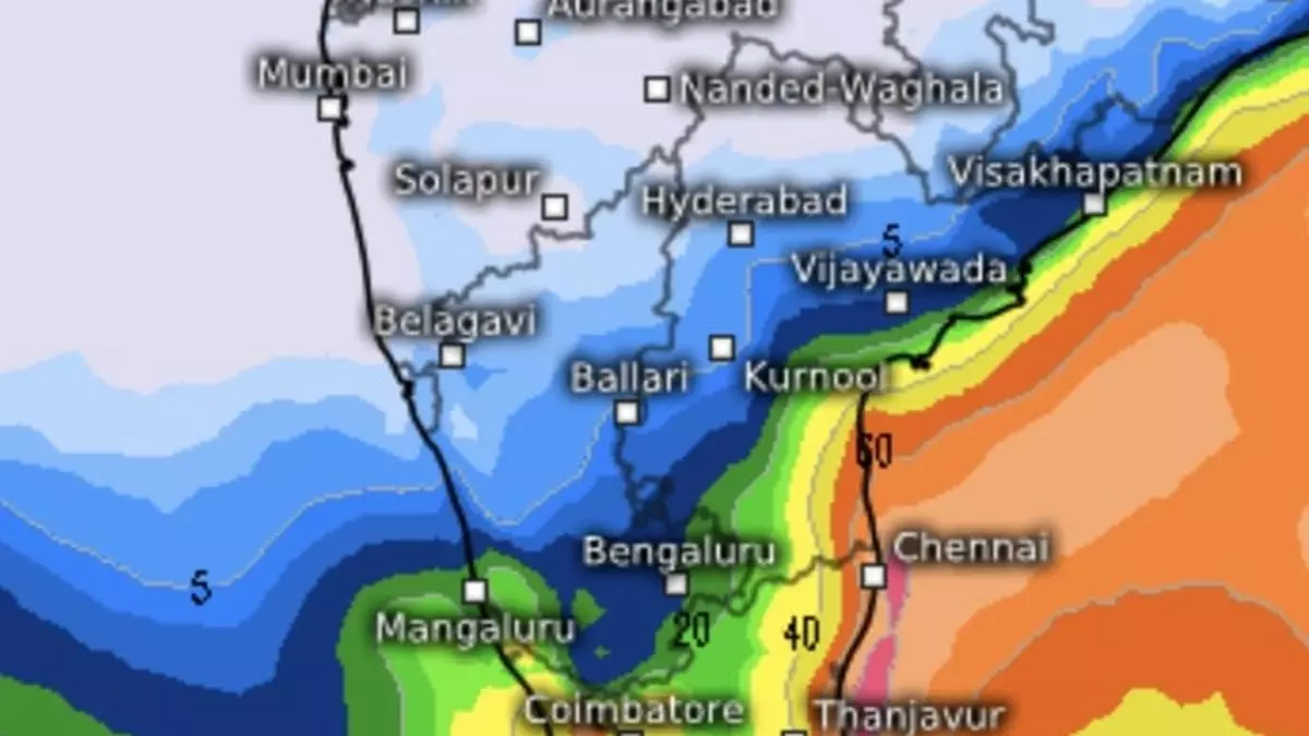
Early indications suggest the brewing circulation over the Bay is for the long haul, and could likely revive the north-east monsoon over South Peninsula. The European Centre for Medium-Range Weather Forecasts (ECMWF) says moderate to heavy rain may fall over the Tamil Nadu coast during the next 10 days, and heavy to very heavy over southern and western parts of Tamil Nadu, adjoining Kerala, south interior Karnataka, north interior Karnataka and coastal Karnataka during this period.
The US Climate Forecast System sees the monsoon driving to a peak during November 13 to 22, and relenting into last week of the month and early December. The US National Centres for Environmental Prediction tends to agree, but points to the coast of entire Andhra Pradesh getting maximum rainfall during November 11 to 19, followed by southern parts of Kerala and Tamil Nadu.
