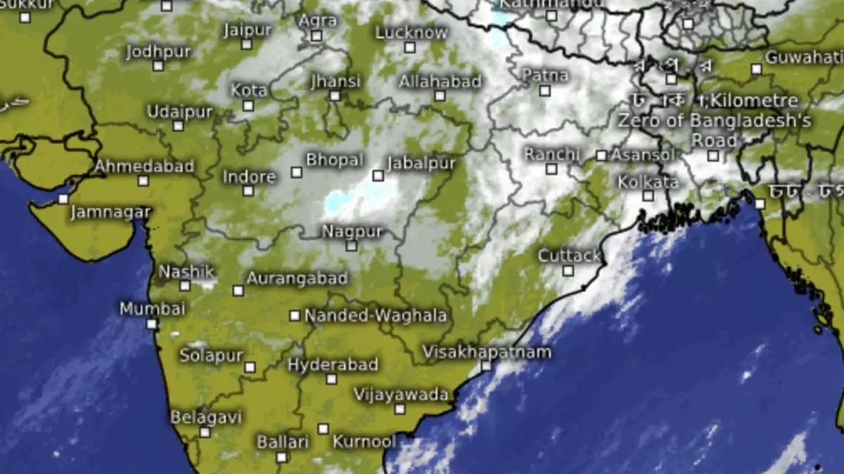
Severe weather over West India, Bay warms up to yet another cyclone
Almost the entire western part of the country has come under severe weather brought on by an active western disturbance and an offspring circulation even as India Meteorological Department (IMD) issued an early alert for yet another cyclone brewing over the South-West Bay of Bengal close to Sri Lanka and Tamil Nadu by early December.
businessline had hinted at this possibility in a report five days ago. This also brings to fore one of the busiest phase yet of the weather over the western parts as well as over the fringes of the eastern and south-eastern parts of the country towards of the end of November and into early December.
Active western disturbance
The western disturbance lay over Central Pakistan on Monday evening while the induced cyclonic circulation had checked already across the international border into North Gujarat and adjoining Rajasthan, an unusually southerly location indicating how deep the system has dug in over the western part of India. Interaction of the system with easterlies from the Bay translated into light to moderate rain, lightning, thunderstorms and even hailstorms over many parts of the region.
Also read: The rippling effect of erratic monsoon
The combined influence of the western disturbance and the baby circulation may have already peaked, the IMD indicated. Apparently, the same cannot be said about the barrage of strong westerly winds it has brought to bear over the region. And this could likely have an impact on the track and strength of the brewing cyclone heading in from the East over the Bay.
Next Bay cyclone
A preparatory cyclonic circulation has already crossed in from the South China Sea, and perched itself over the South Andaman Sea and adjoining Malacca Strait on Monday. It is expected to intensify into a depression by Wednesday and further into a cyclone, the third so far in the season over the Bay, not very far from the Sri Lanka and South Tamil Nadu coast by Saturday (December 2).
Also read: El Nino poses risk to 2024 palm oil output in Indonesia, Malaysia
Stronger westerly winds from the opposite end could likely prevail, and drive up the system along the coast of Coastal Andhra Pradesh and Odisha. The system is forecast to be swung to the North-North-East after it gets yanked by the western wind regime, weakening it in the process. An extended outlook indicates the weakened cyclone may get pushed further to the West Bengal coast. In this manner, the entire East Coast may get spells of moderate to heavy rain during this phase.
Likely wet December
The busy weather over the South Peninsula may take a break after the third cyclone in the Bay blows out but not for far long, according to international model projections. Mid-December is likely to see another phase of enhanced weather activity and bring above normal rainfall for the Tamil Nadu coast. Normal to slightly above-normal rain/shower activity is indicated for the rest of the country. This phase might get carried over into early January, according to the prognostications.
