Severe cyclone Dana crosses north Odisha coast as heavy rain, high winds batter adjoining districts
Severe cyclone Dana over north-west Bay of Bengal moved north-northwestwards and crossed the north Odisha coast close to the Habalikhati Nature Camp (Bhitarkanika) and Dhamara between 1.30 am and 3.30 am early on Friday morning, as predicted by India Meteorological Department (IMD), with wind speed of 100-110 km/hr gusting to 120 km/hr.
The severe cyclone had lain centred at 2.30 am over the Odisha coast without losing strength, about 60 km north-east of Paradip and 20 km south-east of Dhamara (both Odisha), and 150 km south-west of Sagar Island (West Bengal). An hour later, it had moved to about 10 km north of Dhamara and 20 km north-northwest of Habalikhati Nature Camp (Bhitarkanika).
Successful tracking
The track, time, and place of landfall were exactly on the lines predicted by the IMD, providing yet another instance of its expertise in the field. Post-landfall, Dana is expected to move west-northwest across north Odisha and gradually weaken into a cyclone by Friday afternoon. The system is under continuous surveillance by the Doppler weather radar at Paradip.
Dana is expected to weaken into a deep depression by the evening and a depression into the night. Gale winds with speeds reaching 100-110 km/hr and gusting to 120 km/hr may prevail along and off the north Odisha and east Medinipur district of West Bengal into the morning hours on Friday. Wind speeds may range between 60-80 km/hr and gusting to 90 km/hr along and off south Odisha and the rest of coastal West Bengal during the same period.
Rain for Odisha, Bengal
The weakening phase of Dana may bring light to moderate rain to most places of interior Odisha, heavy to very heavy rain at a few places, and extremely heavy rainfall at isolated places on Friday. Squally winds with speeds reaching 40-50 km/hr and gusting to 60 km/hr may prevail in the region and pick up to 50-60 km/hr gusting to 70 km/hr from the afternoon until Saturday morning.
Light to moderate rain is forecast at most places over the Baleswar, Mayurbhanj, Bhadrak, Kendrapara, Jagatsingpur, Kendujhar, Jajpur, Cuttack and Dhenkanal, Khorda and Puri districts of Odisha with heavy to very heavy rain at a few places and extremely heavy rain(≥ 21 cm) at isolated places on Friday. Similar conditions will prevail over the South and North 24 Parganas, East and West Medinipur, Jhargram, Howrah, Hooghly, Kolkata and Bankura districts of neighbouring West Bengal.
Track of Dana remnant
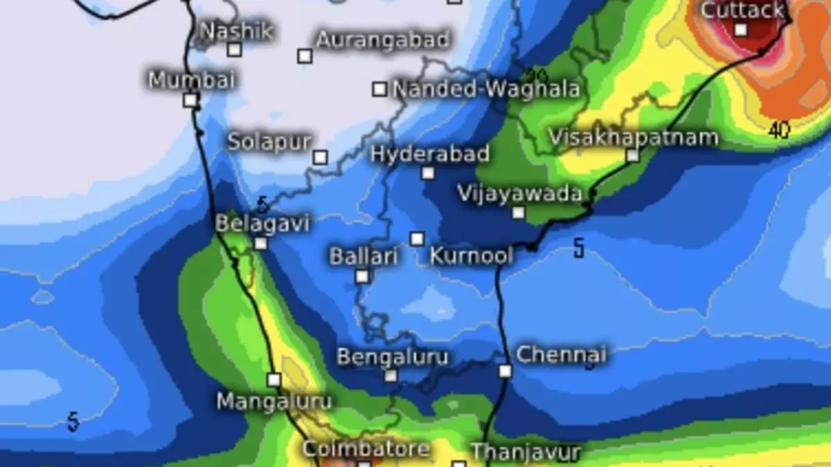
Light to moderate rain is likely at most places over south Jharkhand and south Bihar, with heavy to very heavy rain in a few places and extremely heavy rain in isolated places. A remnant of the cyclone is forecast to slide down the Odisha and north Andhra Pradesh coast, move west over northern parts of the peninsula, and enter the Arabian Sea off the Goa coast. Winds are south-westerly for the time being and will continue to bring rain to the southern parts of Kerala and Tamil Nadu for the next few days.
N-E monsoon set to revive
After having been disrupted by the severe cyclone, the north-east monsoon may revive over the Bay of Bengal from the first week of November, according to numerical model predictions. It may bring organised rain along the Tamil Nadu coast before establishing its strength later. According to the Climate Forecast System model, heavier rain may lash the south peninsula from November 13 to November 22 and reduce only slightly in intensity till early December, when forecasts are available.