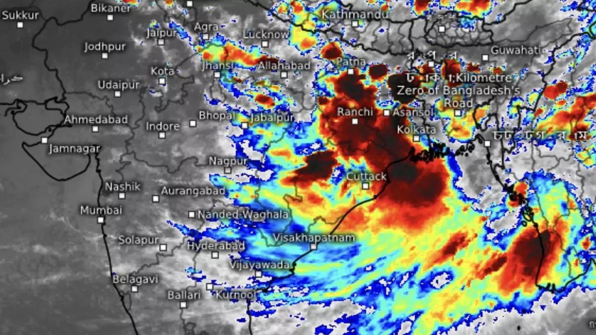
Rare deep depression over Bay slots heavy rain belt over deficient East India
A depression forming over the Bay of Bengal and its further intensification into a rare deep depression on the first day of August on Tuesday signalled a revival of the monsoon over the rain-deficient East and North-East India. Viewed from another perspective, it will progressively confine rains to this region as well as the foothills, leading to an inevitable ‘break-monsoon.’
A break-monsoon signals shut-out of monsoon over large parts of the country, and could last a week, if not more. Some global models delay a revival from South India towards the end of August. Numerical models of India Meteorological Department (IMD) see a follow-up low-pressure area over the North-West Bay around August 10 but its potential needs some watching.
Next ‘low’ in 10 days
The eastern end of the monsoon trough is likely to lift itself dry from the Bay in the next 5-6 days, confirming the break-phase. In fact, the deep depression washing over the coast in a landfall by Tuesday evening would have set this process in motion. The next ‘low’ may coax the monsoon trough-end back into the Bay and trigger another wave of localised rain over East India.
Meanwhile, extremely heavy rain lashed parts of Odisha overnight on Tuesday while it was heavy to very heavy over Jharkhand, East Madhya Pradesh and Madhya Maharashtra under the influence of the depression. It was heavy rainfall over East Rajasthan, East Gujarat, Uttar Pradesh, Bihar, Punjab, Chhattisgarh, plains of West Bengal, Telangana, Konkan and Goa.
Heavy rain for East India
The IMD has forecast moderate to fairly widespread rain, thunderstorm and lightning over parts of Bihar for the next five days; over Odisha for three days; over plains of West Bengal and Jharkhand for two days; and over hills of West Bengal and Sikkim for four days. Isolated extremely heavy rain is likely over Odisha for two days. As for North-East India, moderate fairly widespread to widespread rainfall with isolated heavy rain is predicted for next five days.
Over Central India, moderate scattered to fairly widespread rain and isolated heavy to very heavy fall is likely over East Madhya Pradesh for four days; over North Chhattisgarh for three days; over West Madhya Pradesh for three days from Wednesday; and over Vidarbha on Wednesday. Isolated extremely heavy rain is likely over East Madhya Pradesh on Thursday.
Rains return to North-West
In North-West India, moderate scattered to fairly widespread rain with isolated heavy fall is likely over Uttarakhand and East Uttar Pradesh until Saturday; over Himachal Pradesh, Haryana and West Uttar Pradesh from Thursday to Saturday; and over West Uttar Pradesh and East Rajasthan for four days from Wednesday. Isolated very heavy rain is likely over East Uttar Pradesh until Thursday; over Uttarakhand from Thursday to Saturday; and over Himachal Pradesh on Wednesday and Thursday.
Towards the West, moderate fairly widespread to widespread rainfall with isolated heavy to very heavy falls may continue over Konkan, Goa and the ghat areas of Madhya Maharashtra for five days; over Marathwada on Wednesday; and over East Gujarat on Friday and Saturday. In the South, moderate to widespread rainfall with isolated heavy rain is likely over Coastal Karnataka from Wednesday to Friday.
