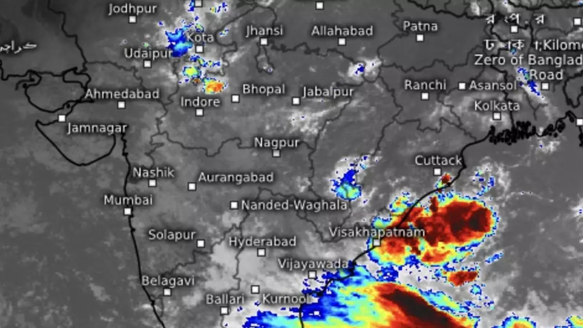
Rajasthan records heavy rain so far this season while rest of north-west India languish
Very heavy rain was recorded over East Rajasthan on Friday while it was heavy over parts of West Rajasthan and adjoining Gujarat Region (North Gujarat, Gandhinagar and South Gujarat) thanks to favourable alignment of the western end of the core monsoon trough near towards its normal position.
Rajasthan has recorded excess to large excess rain as this year’s season approaches close even rest Met subdivisions in North-West India wallow in a shortfall.
South of normal position
This is because the core monsoon trough has remained mostly to the south of its normal position without a full-fledged ‘break’ phase. This alignment favours west, central and peninsular India. During a monsoon break phase, the trough moves to the north, and brings along with due share of heavy to very heavy rain to the Indo-Gangetic planes, hills, and rest of the region.
On Saturday morning, India Meteorological Department (IMD) said the eastern end of the trough remained south of its normal position culminating in central and adjoining north Bay of Bengal where it is hosting the latest low-pressure area. The rain-driving ‘low’ is expected to become a depression by Monday.
The Thailand Met Department said the ‘low’ would concentrate into a ‘well-marked’ by Sunday, in the first round of intensification.
More rain for Rajasthan
The IMD has forecast heavy to very heavy rain (12 cm+) over parts of East Rajasthan on Saturday as well, apart from Konkan & Goa; Madhya Maharashtra and Gujarat Region. It would be heavy (7 cm+) over Saurashtra & Kutch; Assam & Meghalaya; North-East India; Coastal Andhra Pradesh & Yanam; Karnataka; Uttarakhand; South-West Rajasthan, Madhya Pradesh; Chhattisgarh; Bihar; Jharkhand and Odisha.
Squally weather with wind speeds 45-55 km/hr gusting to 65 km/hr may prevail over the Gulf of Mannar, as well as many parts of central and adjoining parts of South Bay as the ‘low’ intensifies.
Outlook for rest regions
Isolated very heavy rain has been forecast also over Uttarakhand and south-west Rajasthan forming part of north-west India meteorological subdivision. Over central India, isolated very heavy over parts of Gujarat Region; ghats of Madhya Maharashtra; Konkan & Goa; while it will be isolated heavy over parts of Chhattisgarh; Saurashtra & Kutch; West Madhya Pradesh; Gujarat Region; East Madhya Pradesh; Konkan & Goa and the ghats.
Over South Peninsula, isolated heavy rainfall is likely over Kerala & Mahe, Coastal Andhra Pradesh & Yanam and Coastal Karnataka on Saturday while in the east and north-east, isolated heavy rain may lash parts of the region during next seven days. Odisha and Bihar may also receive isolated heavy rain the same day.
Super typhoon Yagi
Farther to the east and across Indochina, super typhoon Yagi weakened after slamming the Hainan island in China on Friday, but re-emerged over the South China Sea on Saturday en-route to the Gulf of Tonkin and eyeing the Vietnam coast for a third landfall as a weaker storm.
A remnant of the typhoon may drift to the west and enter the Bay of Bengal to rev up the monsoon Earlier, global agencies said the super typhoon, the strongest to hit Hainan in a decade and the second strongest storm of this year after Beryl in the Atlantic, pounded Hainan with heavy rain and gusty winds.
Yagi was the 11th typhoon in the North-West Pacific basin this year, and made two landfalls in China on Friday, first on Hainan and later Guangdong province.
