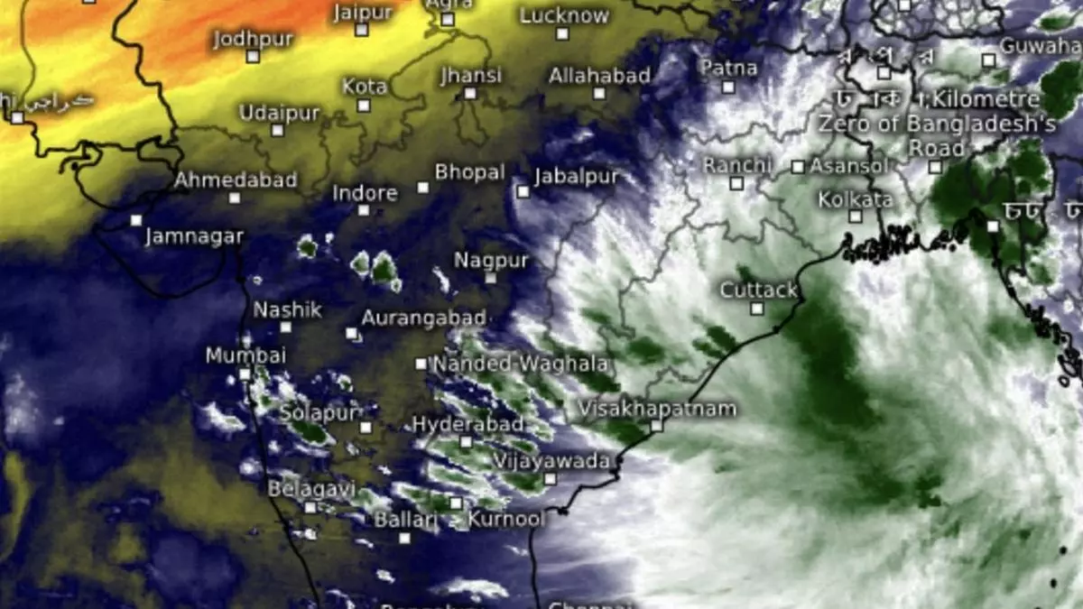
Rains likely for south, east even as monsoon withdrawal gathers pace over north-west India
The June-September south-west monsoon ended on Monday (September 30, 2024), but, India Meteorological Department (IMD) has notified prospects of formation of the first post-monsoon low-pressure area over North Bay of Bengal off the West Bengal coast over the next two days.
Pre-monsoon and post-monsoon phases are fraught with the risk of storm formation in the Bay of Bengal and the Arabian Sea, depending on the speed with which the monsoon exits land. As on Wednesday, it had withdrawn from most of North-West India across entire Jammu & Kashmir-Ladakh; Himachal Pradesh; Uttarakhand; Punjab; Haryana-Chandigarh-Delhi; remaining parts of West Rajasthan; some parts of West Uttar Pradesh; West Madhya Pradesh; and East Rajasthan.
Line of monsoon withdrawal
The line of withdrawal of passed through Lakhimpur Kheri (Uttar Pradesh); Shivpuri (Madhya Pradesh); Kota, Udaipur and Deesa (Rajasthan); and Surendranagar and Junagarh (Gujarat). The IMD assessed conditions as favourable for further withdrawal from remaining parts of West Uttar Pradesh; some more parts Madhya Pradesh; remaining parts of East Rajasthan; some more parts of Gujarat; and some parts of Maharashtra during next 2-3 days.
- Also read: Agri minister Chouhan stresses on solving small issues to help raise farmers’ income by 10-20%
It could likely run into the emerging ‘low’ from Bay which is forecast to careen in a south-west direction along the east coast towards Andhra Pradesh, and head inland to Telangana and adjoining Vidarbha. From here, it would hold back the monsoon withdrawal over East-Central India, and may go on to intensify a bit till October 12, 2024, till when forecasts are available. Invading dry north-westerlies associated with monsoon withdrawal will have been forced to take a brief pause over west India.
MJO wave likely moving in
This is also the time when a rain-friendly Madden-Julian Oscillation (MJO) moves into the Indian Ocean (during October 9 to 22), an outlook by the US Climate Prediction Centre said. It has put both the Bay of Bengal and Arabian Sea under watch with 20-40 per cent chance for storm formation (low-pressure area or depression). This is also the normal window for declaring the arrival of North-East monsoon (reverse monsoon or winter monsoon), marked by reversal of winds to north-east (from south-west).
‘Low’ likely by Friday
“On Wednesday, an upper air circulation lay over South-East Bangladesh, with a trough running down to North Andaman Sea across Myanmar coast. Under its influence, a ‘low’ is likely to form over North Bay and neighbourhood around Friday,” the IMD said. Isolated heavy to very heavy rain is likely over the North-East region and isolated heavy over the hills of West Bengal on Thursday; plains of West Bengal on Friday; North-East region on Friday and Saturday; and over Assam & Meghalaya; Nagaland; Manipur; Mizoram; and Tripura from Sunday to Tuesday.
Rain outlook for east, south
Overall, fairly widespread to moderate rain is likely over the north-east for next seven days. It will be scattered to fairly widespread over Bihar, West Bengal and Sikkim and isolated to scattered light to moderate over Jharkhand and Odisha.
Over the South Peninsula, isolated heavy rain is likely over Tamil Nadu, Puducherry & Karaikal until Sunday; and over Kerala & Mahe on Thursday. It will be fairly widespread to widespread to moderate over Kerala & Mahe; South Interior Karnataka; and Lakshadweep during the week ahead, and scattered to fairly widespread to moderate over Tamil Nadu, Puducherry & Karaikal; Coastal Karnataka North Interior Karnataka. It will be isolated to scattered light to moderate over Coastal Andhra Pradesh & Yanam; Rayalaseema; and Telangana.
