Rain deficit at 18% ahead of likely monsoon surge along West Coast this week
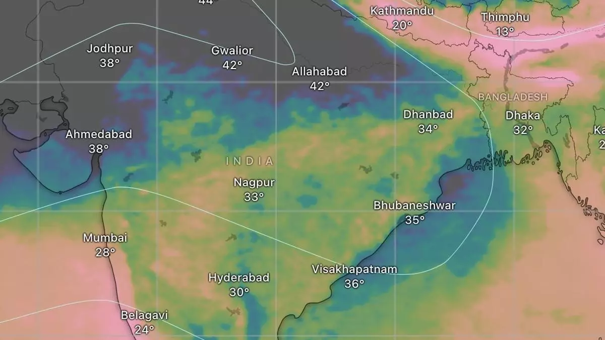
All-India rainfall deficit until Sunday is 18 per cent, extending to an estimated 71 per cent of the geography, even as a decidedly indifferent monsoon runs behind schedule over large parts of Central and East India including eastern parts of Maharashtra; the northern half of Chhattisgarh; the entire Odisha and West Bengal; and eastern parts of Jharkhand and Bihar.
South Peninsula in surplus
Among the four homogenous regions, the South Peninsula has logged above-average rainfall of 22 per cent with most of the surplus going to the East (Rayalaseema, +172 per cent; Tamil Nadu, Puducherry and Karaikal, +114 per cent; and North Interior Karnataka, +94 per cent) while Kerala on the West Coast lagged behind at -42 per cent and Lakshadweep, -68 per cent. The trend may be reversed from this week with projected total accumulated rain looking up with the next monsoon surge materialising within the next three days, as per a forecast by the European Centre for Medium-Range Weather Forecasts (ECMWF).
Manageable deficit elsewhere
North-West India, where the monsoon is yet to arrive, heads the rain deficit tally with -65 per cent, followed by Central India, which has been covered in parts, at a more manageable -25 per cent. East and North-East India, where the monsoon continues to be active, particularly along the hills, has a deficit of -21 per cent. India Meteorological Department (IMD) sees conditions being favourable for the advance of the monsoon into some more parts of Maharashtra, Chhattisgarh, Odisha, Coastal Andhra Pradesh, some parts of plains of West Bengal and the remaining parts of the hills and Bihar during the next four days.
Surge along West Coast
Forecasts indicate rains will be active along the West Coast during this week, with intermittent waves propagating to the Interior Peninsula, southern parts of Central India and along the East Coast. The ECMWF projects a scenario in the next 10 days when rains hold strong over the West Coast and immediate interior (covering Maharashtra, Karnataka, Andhra Pradesh, Telangana, North Interior Tamil Nadu and Kerala) while heavy rains manage to break into Madhya Pradesh, Odisha and South Gujarat as well.
Goa, Coastal Karnataka, Kerala
The entire West Coast might come under the monsoon rage with Goa, Coastal Karnataka and Kerala likely getting soaked to begin with. Later, the heavy rain belt is shown guiding itself further North to the Konkan by June 23 even as Goa, Coastal Karnataka and most of Kerala gear up for another heavier spell during the three days that follow, up till when forecasts are available. The IMD sees some rain in the foothills of the Eastern Himalayas (fringes of West Bengal, Bihar and Uttar Pradesh) as well as over Jammu, Kashmir & Ladakh; Himachal Pradesh; and Punjab during this week, which could be attributed to a passing western disturbance. One such disturbance had checked in over the Iran-Afghanistan border on the way to North-West India.
