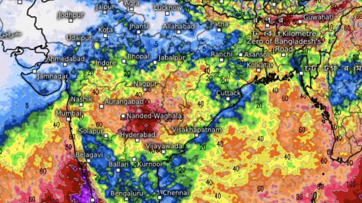
Monsoon Update: West Coast brings rain to Gujarat, Maharashtra, MP, Odisha
Heat wave conditions are being ruled out over most parts of the country during the next four-five days as an expected monsoon surge materialises along the West Coast with favourable implications for adjoining interior (Maharashtra), southern parts of Central India, East and North-East India. India Meteorological Department (IMD) said on Thursday the monsoon has advanced into more parts of Vidarbha, Chhattisgarh, Odisha, hills of West Bengal and some parts of Bihar.
Ongoing heavy to very heavy rain over hills of West Bengal and Assam-Meghalaya may sustain for two days followed by isolated heavy rain. Scattered to fairly widespread light to moderate rain, thunderstorms and lightning may break out to signal monsoon arrival over Gujarat state, apart from a fresh spell for Madhya Maharashtra & Marathwada during next five days.
Northern limit progress
On Thursday, the northern limit of the monsoon passed through Amravati, Gondia, Durg, Rampur (Kalahandi), Malda, Bhagalpur and Raxaul. Conditions are favourable for its further advance into Gujarat State, Maharashtra, Madhya Pradesh, Odisha, plains of West Bengal, parts of Jharkhand, some more parts of Bihar and some parts of East Uttar Pradesh during next four days.
A trough of low-pressure runs off the Karnataka and Kerala coasts in what is a rudimentary form of the all-important offshore trough that initially receives the monsoon moisture from the Arabian Sea. This will lie extended fully along the Kerala-South Gujarat coasts, pumping in the torrents when the monsoon is in peak form. This phase could materialise as early as during the next week, as per indications.
Internal dynamics
Otherwise, the monsoon is seen thriving on internal dynamics without usual help from a low-pressure area over the Bay of Bengal. It is seen making best use of a cyclonic circulation rolled out ahead by a visiting western disturbance over Delhi-Haryana-Chandigarh. This will switch the westerly to north-westerly winds to being helpful south-easterlies and likely herald monsoon around the normal over the national capital. But a dormant Bay could bring back barren westerlies into play sooner than later.
The monsoon surge will bring isolated heavy to very heavy rain to Konkan & Goa and ghat areas of Madhya Maharashtra for five days until Monday. It will be isolated heavy over East Gujarat on Sunday; fairly widespread to widespread light to moderate thunderstorms, lightning and gusty winds over Karnataka, Kerala & Mahe and Lakshadweep; and isolated to scattered light to moderate over Coastal Andhra Pradesh & Yanam; Rayalaseema; Telangana; Tamil Nadu, Puducherry & Karaikal until Monday.
Broad-based burst
The broad-based monsoon bust will trigger isolated heavy to very heavy rain over Kerala & Mahe, Coastal and South Interior Karnataka and Tamil Nadu until Monday; over North Interior Karnataka from Saturday to Monday; and Lakshadweep on Saturday and Sunday. Rains will be isolated extremely heavy for Coastal Karnataka these days; over Konkan & Goa; Kerala & Mahe and South Interior Karnataka on Sunday.
