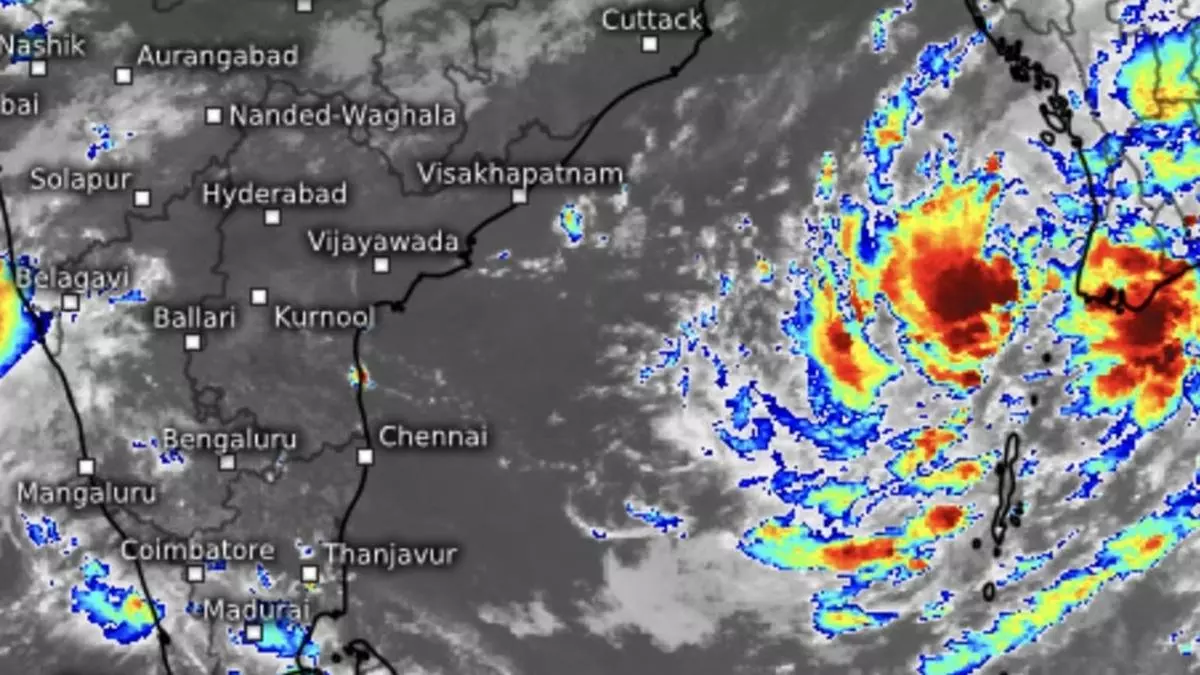
Monsoon Update: Low-pressure area spins up over east-central Bay, Odisha; cyclone Dana goes live
A day after a pre-cyclonic watch was declared for the Odisha-West Bengal coasts, a causative low-pressure area formed over east-central Bay of Bengal and adjoining north Andaman Sea early Monday morning. It is likely to move west-north-west and intensify into a depression by Tuesday and further into a projected cyclone Dana by Wednesday over the east-central Bay in what has now become a familiar trend in terms of rapid transformation of systems over the North Indian Ocean region.
Sea-surface temperatures
The projected trajectory places the would-be cyclone comfortably away from the coast into the sea (east-central Bay), assuring time and space for it to travel and grow in strength in run-up to landfall. On Monday, sea-surface temperatures are warmest (up to 31℃) over the north and northwest Bay, where it is headed first, which should support evaporation and also provide fuel (moisture) for it to grow in strength. Wind shear (change in wind speed and direction with height) values are currently neutral but tend to grow with time, which could cap the storm’s strength and intensity.
No landfall coordinates
India Meteorological Department (IMD) expects the would-be cyclone to move northwest over the east-central Bay and reach the northwest Bay off Odisha-West Bengal coasts by Thursday without indicating a time/day and place for landfall. Meanwhile, another cyclonic circulation persisted on Monday morning over south-west and adjoining west-central Bay off the north Tamil Nadu and south Andhra Pradesh, as did a previously existing low-pressure area over west-central Arabian Sea.
Heavy rain outlook for Odisha
In the context of developing stormy conditions in the Bay, the IMD has predicted light to moderate rain on Monday at most places over the Andaman & Nicobar Islands, with heavy to very heavy rain at isolated places. Light to moderate rain has also been forecast at most places over Odisha with heavy rain at isolated places on Wednesday, while it would be heavy to very heavy at a few places, with extremely heavy rain at isolated places on Thursday and Friday, as projected cyclone Dana approaches coast for landfall. As for plains of West Bengal, light to moderate rain is expected at most places with heavy rain at isolated places on Wednesday, and heavy to very heavy rain on Thursday and Friday.
Rain for South Peninsula
Over South Peninsula, isolated very heavy rain is over Coastal Andhra Pradesh & Yanam on Friday in association with the movement of the projected cyclone, though away to the east and north-east. Isolated heavy rain has been forecast for Tamil Nadu, Puducherry & Karaikal; Kerala & Mahe; and south Interior Karnataka from Monday to Wednesday; Coastal Andhra Pradesh & Yanam on Thursday; and coastal and north Interior Karnataka on Monday. Light to moderate rain is likely at many places over Tamil Nadu, Puducherry & Karaikal; Kerala & Mahe; Lakshadweep; and coastal and south interior Karnataka, accompanied by isolated thunderstorms during the week. Light to moderate rain is forecast over the rest of the region during this period.
