Monsoon Update: Depression over Bay of Bengal sets off humongous rain over TN, Rayalaseema
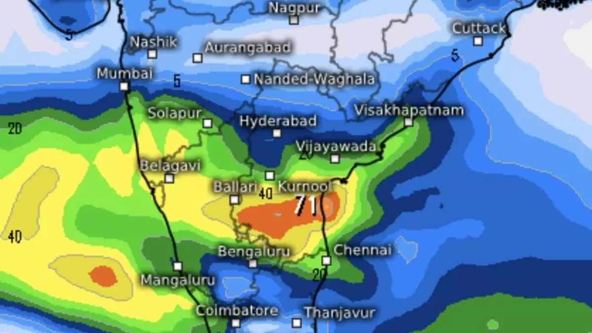
A monsoon depression over south-west Bay of Bengal off the Tamil Nadu and south Andhra Pradesh dumped humongous rains over Tamil Nadu, Puducherry & Karaikal; Rayalaseema; south coastal Andhra Pradesh and Karnataka a day after the north-east monsoon arrived in style over the region.
On Wednesday, the depression was located about 320 km east-south-east of Chennai; 350 km east-north-east of Puducherry; and 400 km south-east of Nellore (Andhra Pradesh). It will continue to move west-north-west move and cross the north Tamil Nadu – south Andhra Pradesh coasts between Puducherry and Nellore, close to Chennai, during early Thursday morning.
No respite for north TN
The IMD is not promising any major respite for a soaked north interior Tamil Nadu on Thursday with light to moderate rain and isolated heavy to very heavy rain being forecast for the day. Light to moderate rain is also likely over most places of south Tamil Nadu, with heavy rain at isolated places. As for south Andhra Pradesh and Rayalaseema, the forecast favours light to moderate rain at most places with heavy rainfall at isolated places. Over Kerala and south interior Karnataka, it will be light to moderate at most places with heavy to very heavy rain at isolated places.
Remnant of depression
The India Meteorological Department (IMD) said heavy to very heavy rain fell at a few places over Tamil Nadu, Puducherry & Karaikal and Rayalaseema, with isolated extremely rain during the 24 hours ending on Wednesday morning. It was heavy to very heavy at isolated places over south coastal Andhra Pradesh and heavy at isolated places over Karnataka.
Numerical model predictions say a remnant of the depression will head inland, and step out into the Arabian Sea off Kerala-Karnataka coasts by Friday and drift further away. The European Centre for Medium-Range Weather Forecasts shows rain intensity decreasing over Kerala, coastal Karnataka, south, west and coastal Tamil Nadu and Andhra Pradesh during the week starting Monday next.
Rogue system brewing?
The week that follows (starting October 28) may witness below-normal rain over entire peninsular India. This is attributed to likely formation of a low-pressure area/depression over the north Bay of Bengal away from the coast of Tamil Nadu and Andhra Pradesh coasts. The IMD expects the system to form over central Bay on October 22 (Tuesday next), and drift towards the Odisha-West Bengal coasts.
Chennai areas pulverised
Prevailing depression in the Bay triggered very heavy to extreme heavy rain over Chennai and neighbourhood with Cholavaram recording 30 cm until Wednesday morning. Other massive rain amounts recorded (above 15 cm) ranged from Red Hills-28; Avadi-25; Zone-1 Kathivakkam- 23; Zone-2 D15 Manali- 21; Zone 06 TVK Nagar-19; Zone 6 D65 Kolathur, Zone 13 U39 Adyar, Puzhal ARG and Zone 07 Ambattur-18; and Zone 1 Thiruvottiyur, Perungudi, Zone 2 Manali, Hindustan University and Ennore AWS-17 each; Perambur, Zone 08 Malar Colony, Good Will School Villivakkam ARG, Zone 03 Puzhal, Ayanavaram Taluk Office, Anna University ARG, Ponneri andThamaraipakkam-16 each; to Ambathur Anna University; MGR Nagar; Sholinganallur, TVK Nagar; Tondiarpet; Zone 05 Royapuram; and Adayar-15 cm each. Sullurpeta in Rayalaseema recorded 22 cm of rain during this period.
