Low-pressure area over Bay in two days, but gains may be limited
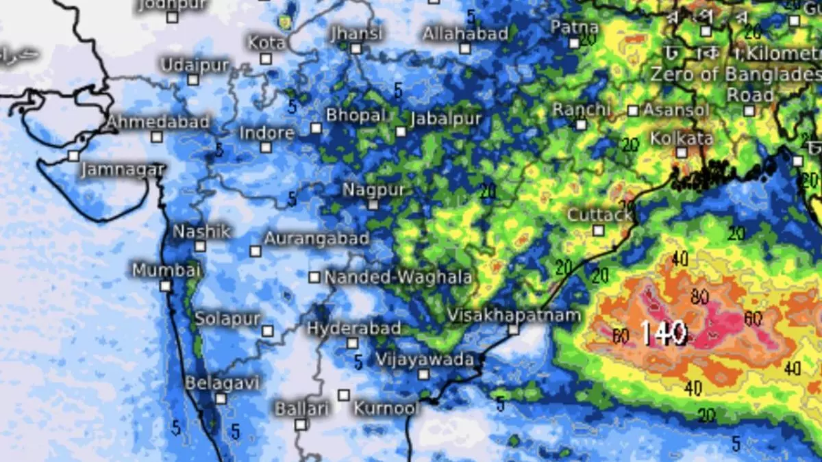
A low-pressure area may form over the North Bay of Bengal by Friday, but indications are it might be short-lived and biased in terms of track of movement. East and East-Central India, as well as flood-hit foothills of North-West and East India, are seen benefiting from a fresh bout of rain into next week.
Extended outlook
India Meteorological Department (IMD) had said in an extended outlook for the week beginning on Thursday light to moderate to fairly widespread rain with isolated heavy falls may lash Central, East, North-East and North Peninsular India during most days of the week. Overall, rainfall may be above normal over Central India; normal to above-normal over most parts of East, North-East and South India; and below-normal over North-West India during the week.
Wait may last longer
But its daily outlook on Wednesday said only Coastal Andhra Pradesh (Friday and Saturday) and Telangana (Saturday) could hope to get light to moderate scattered to fairly widespread rain, thunderstorms, lightning and isolated heavy rain. Rainfall would be subdued over the rest of the country except the aforementioned areas during the week. Global models tended to suggest early September as the most likely timeline for rains to break over dry South India.
Rain deficit at -5 per cent
The rain deficit for the country came in at -5 per cent as a looming rain-killer El Niño over the East Equatorial Pacific weighed in heavily over regional weather. Former secretary of the Ministry of Earth Sciences and leading monsoon scientist M Rajeevan tweeted that the current ‘monsoon break’ is one of the longest on record, having extended for ten days at a stretch. The longest consecutive break spell was from July 18 to August 3 in 1972, a deficient monsoon year. End-July and August are prone to breaks after the monsoon has been kept busy for weeks/months together.
Monsoon trough
The rain-sustaining monsoon trough lies along the foothills of the Himalayas, having triggered massive floods and landslides in Uttarakhand and Himachal Pradesh. It is likely to gradually shift southwards and position near its normal position from Friday in time to receive the low-pressure area from the Bay, allow moisture-laden winds to blow in, and set up rain over East and adjoining East-Central India.
Follow-up ‘low’ seen
The ‘low’ may loiter over the eastern parts and the foothills in the face of resistance from westerlies from an incoming western disturbance., with a follow-up ‘low’ likely around August 25. The West Coast may partly get some showers next week, but Kerala may see the deficit worsening since an unfriendly ridge (high-pressure area) over the nearby Arabian Sea waters shows no sign of relenting anytime soon.
Dire situation in Kerala
Kerala finds itself in a dire situation with reservoir levels depleting fast. The water level at Idukki, the largest, receded to 31.6 per cent on Wednesday. It compares with the 30.20 per cent reached in 2017 on the same day, and is in sharp contrast to last year’s (2022) position when same-day level was as high as 81 per cent; 66 per cent in 2021; 65 per cent in 2020; and 45 per cent in 2019. Reservoir shutters had to be kept open around 2018 during the century’s worst floods.
Hydel generation
Low reservoir levels have implications for hydel power generation, which Kerala depends for 70 per cent of its needs. Daily consumption during August normally is 80 million units (mu), but it reached 85 mu last week. The state finds itself in a situation where it has to buy power from the open market for ₹10-15 core dailywhen it old excess capacity for an estimated ₹1,000 crore last year.
