Low-pressure area over Bay in next two days, may strengthen monsoon
South-West monsoon conditions ‘are establishing’ over Sri Lanka, day after India Meteorological Department (IMD) declared the onset over Maldives and adjoining Comorin region, the South Bay of Bengal, Nicobar Islands and South Andaman Sea. In an update on Monday, Myanmar said the monsoon may make a delayed entry over its southern parts over the next two days.
The extent of spatial spread of the area under onset extending from Maldives and the South Andaman Sea might point to an earlier-than-thought arrival of Kerala. This is because Maldives rarely gets a mention in the same breath as the South Andaman Sea in IMD’s onset statement. Normally, the monsoon enters Kerala a week after it hits Sri Lanka.
Pre-monsoon showers
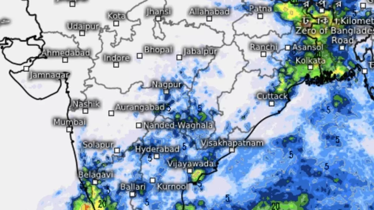
Most of the state and areas straddling the Western Ghats in neighbouring Tamil Nadu have been receiving heavy to very heavy pre-monsoon showers over the past three to four days. Helpful atmospheric formations took guard in the neighbourhood. Of these, a cyclonic circulation hovered over South Coastal Tamil Nadu with a trough originating from it and running towards Marathwada. Another circulation hung over North Kerala. All these will merge to form a trough of their own as early as on Tuesday to set up a low-pressure area over the West-Central Bay of Bengal, not far off from Chennai coast, by Wednesday.
Low-pressure area soon
The IMD has put the ensuing ‘low’ under watch for intensification as a depression by Friday. Short-to-mid-term outlook suggests it could intensify further as a cyclone with a track towards Odisha-West Bengal coasts. Some global weather models agree with system formation in the Bay, though a few ventured to point to Myanmar-Bangladesh as likely destination. Given the circumstances, the IMD has predicted fairly widespread to widespread light to moderate rain accompanied with thunderstorms, lightning and gusty winds over Tamil Nadu, Puducherry & Karaikal; Kerala & Mahe; Lakshadweep and Karnataka for next five days. It will be Isolated to scattered light to moderate over Coastal Andhra Pradesh & Yanam and Telangana.
- Also read: IMD predicts above-normal monsoon
More rains forecast
Isolated heavy rain is likely over Coastal and South Interior Karnataka from Tuesday to Thursday; over Lakshadweep until Friday; and Tamil Nadu, Puducherry & Karaikal from Wednesday to Friday. It will be isolated heavy to very heavy over Tamil Nadu, Puducherry & Karaikal on Tuesday; and Kerala & Mahe on Thursday and Friday. Isolated extremely heavy rainfall is forecast over Kerala until Wednesday.
Widespread light to moderate rainfall is likely over Andaman & Nicobar Islands during next seven days as the depression forms and heads to the North-East over the Bay waters. Monday’s trough extending from South Coastal Tamil Nadu to Marathwada may bring isolated light to moderate rain, thunderstorms, lightning and gusty to Konkan & Goa; Madhya Maharashtra; Marathwada; Vidarbha; Chhattisgarh; and Madhya Pradesh.
