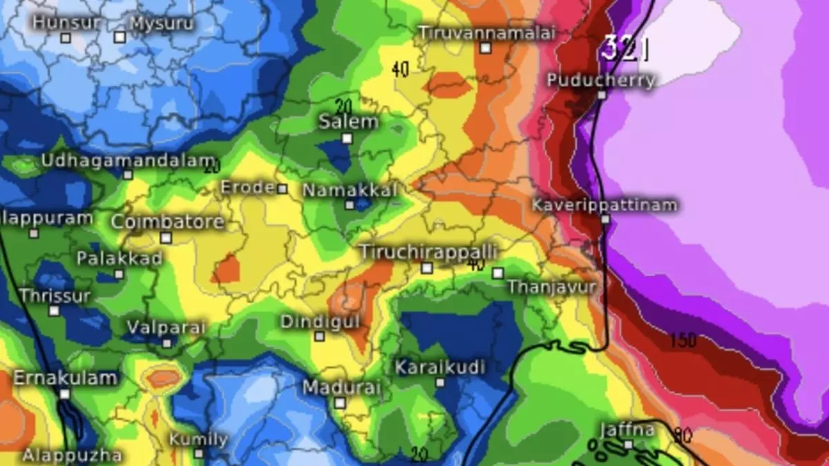
Low-pressure area forms over Bay of Bengal, may become more ‘marked’
A low-pressure area has formed over south-east Bay of Bengal and adjoining east Equatorial Indian Ocean on Saturday morning. It is likely to move west-northwest and become more marked by Sunday, India Meteorological Department (IMD) update said.
It may move west-northwest and roll over into south-west Bay off Sri Lanka–Tamil Nadu coasts over the next four days (by Wednesday next). The IMD, however, did not indicate whether the well-marked ‘low’ will further intensify.
The forecast outlook for the next few days during the emerging week is as follows:
- Read also: Fresh ‘low’ on Fengal’strail, to bring more rain to coastal Tamil Nadu, Andhra Pradesh next week
Tamil Nadu, Puducherry & Karaikal: Light to moderate rainf at many places with heavy rain at isolated places for four days from from Tuesday to Friday. Very heavy rain is likely at isolated places over coastal Tamil Nadu on Thursday.
Coastal Andhra Pradesh & Yanam: Light to moderate rain is many places with heavy rain at isolated places on Wednesday and Thursday.
Kerala & Mahe: Light to moderate rain is expected in many places with heavy rain in isolated places from Wednesday to Friday.
Fishermen alert issued
A warning issued to fishermen advised them not to venture into south-east Bay from Saturday to Wednesday, south-west Bay from Monday to Thursday, and west-central Bay on Wednesday and Thursday.
A fresh western disturbance as a trough lay over central Pakistan on Saturday morning on its way to North-West India. Its steaming engine at the front will bring moisture and clouds into the region and trigger light/moderate rain/snow over the hills from Sunday to Wednesday; and light rain over the plains over Punjab, Haryana and Chandigarh on Sunday and Monday.
Western disturbance on move
This will drive away dense fog to pockets of Assam & Meghalaya & Nagaland, Manipur, Mizoram & Tripura till Monday; but bring it back to Punjab, Haryana, Chandigarh and Jharkhand from Sunday to Tuesday; Uttar Pradesh from Monday to Thursday; hills of West Bengal and Sikkim till Tuesday; and Himachal Pradesh from Tuesday to Thursday.
Westerlies associated with the western disturbance will also shear off the northern flanks of the incoming rain wave over the Tamil Nadu coast, though it will not be able to hold back the rain for long. Meanwhile, the European Centre for Medium-Term Weather Forecasts indicates a follow-up rain wave may be headed for the Tamil Nadu coast by December 15.
