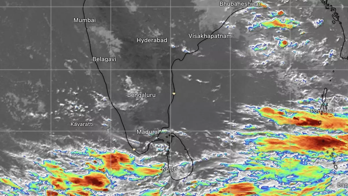
Lean rain phase over South Peninsula likely to end as clouds approach from Bay, Lanka side
The India Meteorological Department (IMD) has predicted light to moderate scattered rainfall, with isolated heavy rainfall over Tamil Nadu, Puducherry and Karaikal; Kerala; North Coastal Andhra Pradesh; and Telangana during the first few days of September, even as the monsoon entered the last month. Isolated very heavy rainfall is likely over Tamil Nadu, Puducherry and Karaikal on Friday.
Light to moderate to fairly widespread to widespread rainfall, thunderstorms and lightning and isolated heavy rain are likely over Chhattisgarh on Saturday and Sunday. Satellite pictures on Friday morning showed clouds approaching Sri Lanka, Tamil Nadu and Kerala, where a stubborn and persistent high-pressure area had repelled them for weeks together .
End to dry patch
Lack of moisture and rain, combined with out-of-turn heat wave conditions in Kerala, had created drought-like conditions over the region during the period, culminating in one of the driest Augusts for close to a century. Dams and reservoirs have been reduced to half their usual levels in Kerala, putting in question electricity and drinking water availability during the rest of the year.
The ensuing summer (2024) could prove disastrous unless the North-East monsoon turns in good numbers for Kerala during October to December. The IMD has said it would come out with its outlook for the ensuing season towards September-end. The North-East monsoon kicks in from the middle of October, even as the withdrawal of the preceding South-West monsoon gathers steam.
Combined effect
What appears to have failed the normal monsoon forecast (June-September) appears to be the combined effect of a building monsoon killer El Niño over the Central and Equatorial East Pacific and the slower-than-expected evolution of a positive Indian Ocean Dipole (IOD) nearer home, which would have neutralised the impact from an El Niño in the far-away Pacific.
IOD has since turned positive, but will take a few more weeks before an official declaration is made, says the Australian Bureau of Meteorology. In fact, the churn here is perceived as rustling up the ongoing revival of the monsoon over the South Peninsula, and progressively over Central and adjoining East India. An updated US agency forecast suggests it may last till the month-end.
Likely near-normal
According to a short-term outlook from the IMD, near-normal rainfall activity is likely over the country in the next two weeks. Light to moderate to scattered to widespread rainfall, with isolated heavy fallsare likely over most parts of the South Peninsula and adjoining central parts of the country during this period.
Region-wise, rainfall activity is likely to be above normal over most parts of the South Peninsula; normal to above normal over Central India; and below normal over North-West, East and North-East India, except over the plains of West Bengal and Odisha, where normal to above normal rainfall activity is likely to occur during the period.
