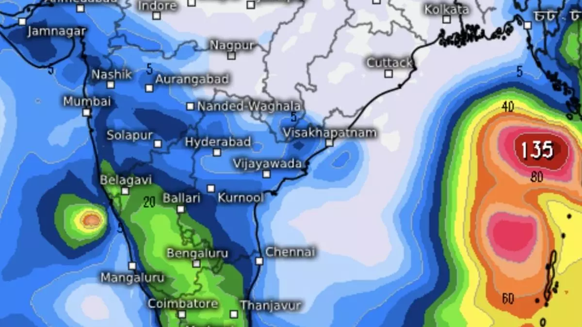
IMD upgrades storm outlook to severe cyclone as ‘low’ becomes well-marked over Bay of Bengal
The India Meteorological Department (IMD) has upgraded cyclone outlook over east-central Bay of Bengal to that of a severe cyclone even as a causative low-pressure area over east-central Bay and adjoining north Andaman Sea moved west-north-westwards and became ‘well-marked’ by Monday noon in the first of a projected six-step intensification process.
‘Low’ becomes well-marked
The well-marked ‘low’ will move west-north-west and intensify into a depression by Tuesday morning and further into a cyclone Dana by Wednesday without appreciable lateral movement over the waters.
Later, it may shift track slightly to move north-west (away from the Andhra Pradesh coast), and head into north-west Bay off Odisha-West Bengal coasts by Thursday morning.
Severe cyclone at landfall
Continuing to move north-west, it may cross north Odisha and West Bengal coasts between Puri and Sagar Island between Thursday night and early Friday morning as a severe cyclone with wind speeds of 100-110 km/hr gusting to 120 km/hr.
The IMD did not indicate if it would intensify to still higher levels before landfall, as a few global storm tracker models appeared to suggest.
High SSTs, lower wind shear
The well-marked ‘low’ has already entered a space where sea-surface temperatures (SSTs) are elevated. On Monday afternoon, the SSTs ranged in the region of 29-31℃, with the maximum settled over north and north-west Bay off the Odisha and West Bengal coasts where the cyclone is moving into.
Wind shear values (change in wind speed and direction with height) are low and therefore helpful, but international models indicate a tendency to increase, limiting the growth potential of the storm.
Riding on itinerant MJO wave
The cyclone is seen riding a passing Madden-Julian Oscillation (MJO) wave that passes over the Indian Ocean during the week beginning Wednesday.
While moving further and away from the Indian Ocean to the Maritime Continent (Malaysia, Indonesia et al), the wave may trigger storms/typhoons over the South China Sea just upstream of the Bay, and to east of the Philippines.
Heavy rain outlook for Odisha
The IMD has predicted light to moderate rain at most places over Odisha with heavy rain at isolated places on Wednesday, while it would be heavy to very heavy at a few places, and extremely heavy rain at isolated places on Thursday and Friday, as projected cyclone Dana approaches coast for landfall.
As for plains of West Bengal, light to moderate rain is expected at most places with heavy rain at isolated places on Wednesday, and heavy to very heavy rain on Thursday and Friday.
Rain for South Peninsula
Over South Peninsula, isolated very heavy rain is over Coastal Andhra Pradesh & Yanam on Friday in association with the movement of the projected cyclone, though farther away to the east and north-east.
Isolated heavy rain has been forecast for Tamil Nadu, Puducherry & Karaikal; Kerala & Mahe; and south Interior Karnataka until Wednesday; and Coastal Andhra Pradesh & Yanam on Thursday.
Light to moderate rain is likely at many places over Tamil Nadu, Puducherry & Karaikal; Kerala & Mahe; Lakshadweep; and coastal and south interior Karnataka, accompanied by isolated thunderstorms during this week. Light to moderate rain is forecast over the rest of the region during this period.
Brief recess in N-E monsoon
International models indicated that a lean monsoon phase would establish briefly over the South Peninsula after the cyclone blows over.
Below-normal rain is forecast for the region from October 30 to November 8. The north-east monsoon may revive during November 9 to 18, and peak over extreme south peninsula (southern Kerala and Tamil Nadu).
Spill-over gains may benefit north Kerala; coastal, south interior and north interior Karnataka; Rayalaseema; and south coastal Andhra Pradesh.
