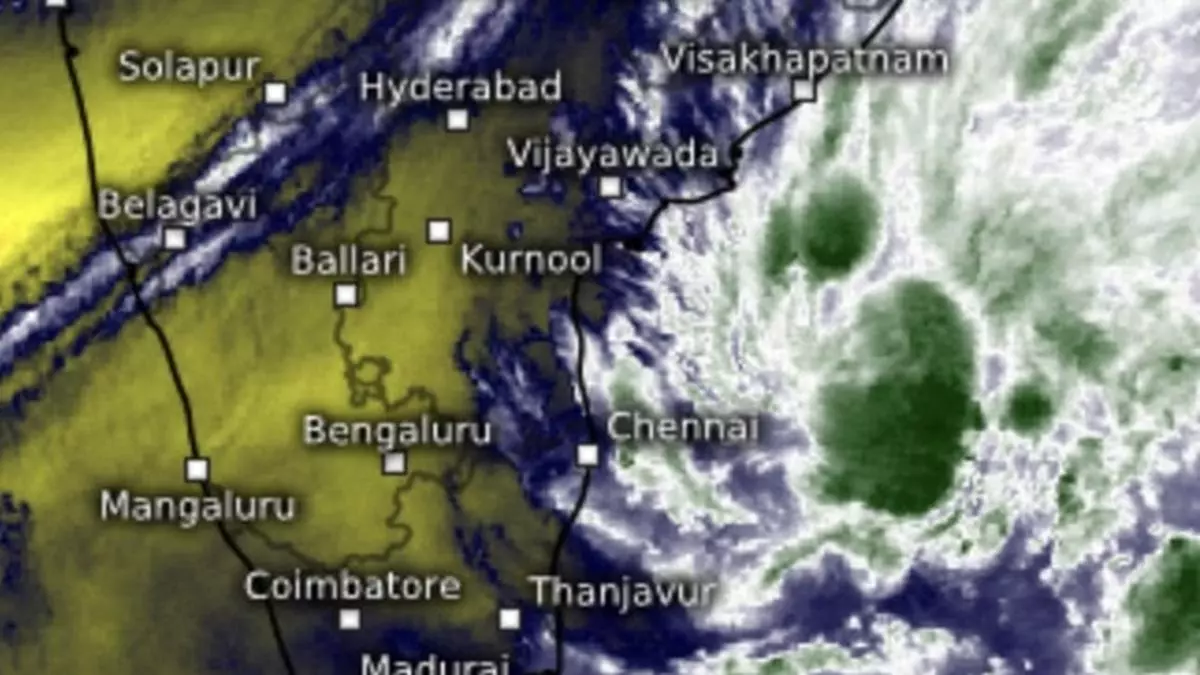
IMD Update: Well-marked ‘low’ over west-central Bay may intensify depression away from East Coast
The well-marked low-pressure area over south-west and adjoining west-central Bay of Bengal lay over west-central and adjoining south-west Bay on Friday morning. India Meteorological Department (IMD) has put it under watch for intensification as a depression even as the north-east monsoon season prepares to draw to a close.
Expected movement further of the system away from the coast to an environment of higher sea-surface temperatures and lower wind shear values supports system intensification. The well-marked ‘low’ may concentrate into a depression over west-central Bay by Friday evening-early Saturday morning, and retain status as a depression through the rest of the day.
Squally weather likely
An assessment of sea sea conditions valid for four days said squally weather with wind speeds of 40-50 km/hr gusting to near-cyclonic 60 km/hr is likely to prevail initially along and off north Tamil Nadu and Andhra Pradesh coasts and progressively along the Odisha coast and many parts of west-central Bay. Fishermen have been advised not to venture into these areas.
- Read also: Rain belt from well-marked ‘low’ expected to shift to coastal Odisha and West Bengal by weekend
Light to moderate rain is likely at a few places over coastal Odisha and coastal areas of plains of West Bengal on both Friday and Saturday; over Assam & Meghalaya for three days from Saturday; and over Nagaland, Manipur, Mizoram & Tripura for four days.
Active western disturbance
Scattered to fairly widespread light to moderate rain is likely over parts of South Peninsula from December 27 to coincide with arrival of an active western disturbance across North-West India. businessline had alluded to this likelihood in these columns yesterday. This phase will bring isolated to scattered light to moderate rain likely also over Madhya Pradesh and Maharashtra.
On Friday morning, a prevailing western disturbance moved in from Umarkot over extreme south-east Pakistan to cross the international border and enter south-west Rajasthan. An induced cyclonic circulation had preceded it was perched over north-west Rajasthan. The next active western disturbance will not be in until after a week, which exposes the region to bitter cold.
Freezing temperatures
On Thursday, minimum (night) temperatures fell by 1-2℃ over some parts of Jammu-Kashmir and risen by 2-3℃ over many parts of East Madhya Pradesh, Chhattisgarh and Marathwada. It was freezing low at 0°C over most parts of Jammu, Kashmir & Ladakh; 1-5°C over Himachal Pradesh; 3-6°C over major parts of Uttarakhand, Punjab, Haryana, Chandigarh, Delhi and West Rajasthan; 6-12°C over most parts of Uttar Pradesh, Bihar, Jharkhand & Central India.
Cold wave conditions
Cold wave to severe cold wave conditions may prevail for three days in some parts of Himachal Pradesh and for two days in isolated pockets over West Rajasthan. Cold wave conditions are likely in parts of Punjab on Friday; in isolated pockets over Punjab on Saturday and Sunday; over Jammu-Kashmir-Ladakh for six days; over Haryana-Chandigarh on Saturday and Sunday; West Rajasthan on Sunday and Monday; and over Himachal Pradesh on Tuesday and Wednesday.
Dense fog is likely during late night/early morning hours in isolated pockets of Punjab and Haryana on Friday and from three days from Sunday; over Uttar Pradesh till today (Friday); over East Rajasthan and Jharkhand for three days from Friday; and over West Bengal, Sikkim and Bihar on Saturday and Sunday. Ground frost is likely over pockets of Himachal Pradesh for four days.
