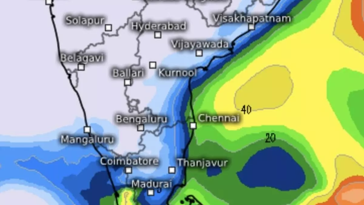
IMD Update: Tamil Nadu, coastal AP, forecasted isolated heavy rain
Isolated heavy rain has been forecast for the next six days over Tamil Nadu; for three days from Monday to Wednesday next over Coastal Andhra Pradesh & Yanam and Rayalaseema; and on Wednesday and Thursday next over Kerala & Mahe, as India Meteorological Department (IMD) signalled to a low-pressure area developing off Tamil Nadu and Sri Lanka coasts next week.
Heavy rain recorded
Heavy rain lashed isolated places over Tamil Nadu, Puducherry & Karaikal during the 24 hours ending on Friday morning as the causative cyclonic circulation over the southwest Bay of Bengal off Sri Lanka developed traction. Stations recording heavy to very heavy rain (in cm) during this period included Manali-11; Zone 03 Madhavaram-10; Sembanarkoil PWD, Velankanni, Madhavaram_CMWSSB and Mattancherry-9 each; Zone02 Manali-8; Zone 06 D65 Kolathur, Thirparappu, Zone 01 Thiruvottiyur, Good Will School Villivakkam ARG and Sirkali-7 each.
Even more predicted
IMD has predicted isolated very heavy rain for Tamil Nadu, Puducherry, and Karaikal on Saturday. Thunderstorms accompanied by lightning are likely at isolated places over these areas. Squally weather with winds speeding to 35-45 km/hr and gusting to 55 km/hr may prevail over many parts of southwest and adjoining west-central Bay, off north Sri Lanka and Tamil Nadu coasts, Gulf of Mannar, and the adjoining Comorin. Fishermen are advised not to venture into these areas.
Clouds spread out over TN
Satellite pictures on Friday afternoon showed clouds spreading out over south Tamil Nadu as also adjoining Kerala. They emerged from the southwest Bay and hung into place east to west from Sri Lanka to coastal Tamil Nadu across Pattukottai, Rameswaram, Thoothukudi and Tirunelveli and further to Pudukkottai, Karaikudi, Madurai, Pollachi and Periyar National Park and almost entire Kerala. Rains were being reported concurrently from Thiruvananthapuram in Kerala and Jaffna, Mannar, Puttalam and Negombo along the west coast of Sri Lanka.
North-east monsoon booster
The low-pressure area will help the northeast monsoon to entrench over the South Peninsula after being flipped over briefly by severe cyclone Dana earlier last month. The IMD expects the ‘low’ to move nearly westwards towards Tamil Nadu/Sri Lanka coasts into the week beginning Sunday. A trough runs from prevailing cyclonic circulation over southwest Bay to east-central Bay. Another circulation lies over the southeast Arabian Sea and adjoining Lakshadweep, which is helpful for the northeast monsoon.
US model outlook
The latest outlook from the US Climate Forecast System suspects the ongoing varyingly wet weather over the South Peninsula may extend into the first week of December. This is based on the expectation that the prevailing rain regime may feed into a counterpart weather system being triggered over North India by a passing western disturbance and sustain itself in the process. Earlier estimates from the US model had indicated that a lull may materialise over the South Peninsula in early December.
