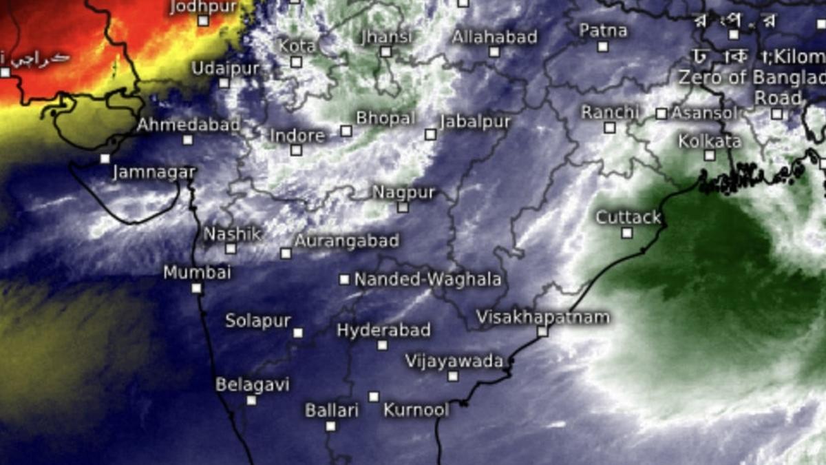
IMD Update: Depression delivers heavy rain to soaked Rajasthan, Madhya Pradesh
Wednesday’s depression over northwest Madhya Pradesh appeared to have overstayed its welcome as it dumped heavy to very heavy rain on a soaked Rajasthan. The meteorological subdivision of West Rajasthan has received a large excess of 79 per cent rain over the long-period average till date while East Rajasthan ran up not too far behind with 49 per cent. Other met subdivisions of north-west India region have reported deficient rain except in one (Haryana-Chandigarh-Delhi).
Depression holds on
Hosts Madhya Pradesh was the other state to receive heavy to very heavy rainfall on Wednesday, an India Meteorological Department (IMD) update said as the causative depression was practically unmoved over northwest Madhya Pradesh from its overnight perch, about 50 km north of Gwalior (Madhya Pradesh); 60 km south-southeast of Agra (Uttar Pradesh); 130 km south of Aligarh (Uttar Pradesh); and 140 km north-northwest of Jhansi (Uttar Pradesh).
Heavy rain for northwest
Outlook for Thursday said heavy to very heavy rainfall (12 cm+) with extremely heavy falls (20 cm+) is likely over Uttarakhand, West Uttar Pradesh, West Madhya Pradesh; heavy to very heavy also over Haryana-Chandigarh, East Rajasthan, East Uttar Pradesh, East Madhya Pradesh and Nagaland, Manipur, Mizoram & Tripura; and heavy (7 cm+) over Himachal Pradesh, West Rajasthan, plains of West Bengal, Arunachal Pradesh, Assam & Meghalaya, and Madhya Maharashtra.
May start to reverse
The depression may start reversing, and move slowly to north-north-east towards the plains of northwest India by Friday. It will gradually weaken as a successor circulation brews over northwest Bay of Bengal. An incoming pulse from South China Sea had moved in from central Myanmar on Thursday morning towards west-central Myanmar. It is likely to move further to west-north-west and emerge over coastal Bangladesh and adjoining northwest Bay by Friday.
Track of successor system
The monsoon trough over land lay in wait to receive this system, and on Thursday, passed through Bhatinda, Hissar, Delhi, the centre of depression and adjoining south Uttar Pradesh, Satna, Daltonganj, Bankura, Haldia and further into the Bay. Numerical prediction models initially put the brewing system on a westerly track towards and central India before it exits the Saurashtra-Kutch coast into the northeast Arabian Sea. It might even intensify a round just before exiting the coast.
Beat back withdrawal signs
In this manner, the system may go on to achieve what predecessor depression failed to – unsettle the monsoon withdrawal and send it back to the drawing board at least until September 22, till when forecasts were available on Thursday. But the Bay will have not yet been finished by then, since numerical weather projections indicate signs of further wind convergence immediately after, likely throwing up a circulation. This will need further verification and confirmation by the IMD though.
Western disturbance persists
Elsewhere on Thursday, a western disturbance as a trough persisted over central Pakistan. The offshore trough along south Gujarat to North Kerala coast also held itself up, as did a cyclonic circulation over south Gujarat. These two weather systems support the larger monsoon circulation active over land, though fast approaching September 17, normal date of start of withdrawal from north-west India. It may take close to a month for it to complete, and monsoon to exit entire landscape.
