Heavy to very heavy rain to return to Andhra Pradesh, Telangana from today
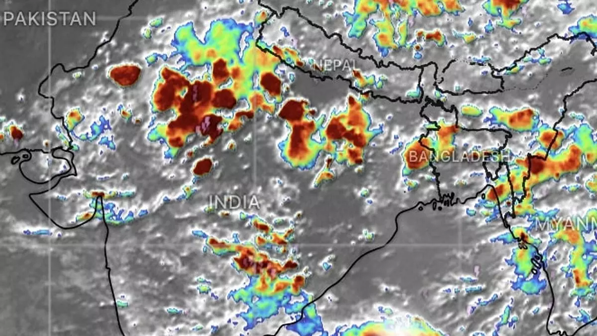
India Meteorological Department (IMD) confirmed an existing low-pressure area over South-East Rajasthan and South-West Madhya Pradesh weakened in anticipation of formation of a fresh one off the North Andhra Pradesh coast and neighbourhood by Thursday. A preparatory cyclonic circulation has already formed over North Coastal Andhra Pradesh by Wednesday evening.
This will bring isolated very heavy rainfall to Coastal Andhra Pradesh & Yanam and Telangana on Thursday as well. Isolated heavy rainfall is likely over Coastal Andhra Pradesh & Yanam; Telangana; Coastal Karnataka; and North Interior Karnataka for four days until Sunday; South Interior Karnataka until Saturday; and over Kerala & Mahe for three days from Sunday to Tuesday.
Widespread rain seen
Fairly widespread to widespread light to moderate rainfall is forecast over West and Central India during the week. Isolated heavy rainfall is likely over Chhattisgarh during next seven days; over Eas tMadhya Pradesh, Saurashtra & Kutch for three days; over Konkan & Goa until Sunday; ghat areas of Madhya Maharashtra from Friday to Sunday; over Gujarat Region (North Gujarat, Gandhinagar and South Gujarat) for four days until Sunday; and Vidarbha, on Tuesday next.
Isolated heavy rainfall is forecast for North-West India, but may not sustain in view of weakening of the resident ‘low.’ Instead, a rain-suppressing high-pressure area (ridge) will develop here, which will make most of the lag with which the brewing ‘low’ cross the West Bengal coast by September 12. How far the emerging rain bands from the ‘low’ tackle the ridge remains to be seen.
Pacific typhoon pulse
Early indications suggest the bands may make inroads into the plains of North-West India, bolstered by an incoming pulse from West Pacific typhoon Yagi. Global models said Yagi may be headed for multiple landfalls over South-West China and Vietnam before the pulse travels into Myanmar and enters the Bay of Bengal to impact the ‘low’ as it crosses the West Bengal coast.
Nitin Bassi, Senior Programme Lead, Council on Energy, Environment and Water (CEEW), said recent floods can be attributed to an increase in rainfall intensity and magnitude during July and August compared to last 30 years. “There are specific reasons that accentuate the impact, ranging from poor regulation on land use changes; disruption of natural drainages; high runoff from growing built-up areas; ineffective solid waste management policy; and poor design of stormwater drains,” he told businessline.
Revisit hydrological assessments
Solution lies in revisiting hydrological assessment of regions or cities to estimate peak flood flow and volume at different scales; undertaking risk assessments to identify flooding ‘hotspots’; managing flood risk through specific interventions; and strengthening flood forecasting systems. A CEEW study shows monsoons are becoming more erratic, with more short bursts of heavy rain. “There is a need to focus on rejuvenating existing wetlands and water bodies and developing solid waste management campaigns to nudge community behaviour,” Bassi added.
