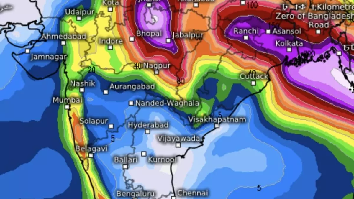
Heavy rain predicted for MP, Gujarat and Vidarbha as depression digs in over central India
A rain-driving depression lay centred over land over North Chhattisgarh; 70 km east-southeast of Bilaspur (Chhattisgarh); 140 km northeast of Raipur (Chhattisgarh); and 220 km east of Malanjkhand (East Madhya Pradesh), India Meteorological Department (IMD) said on Tuesday evening. It may move to west-northwest across north Chhattisgarh and weaken into a well-marked low-pressure area over Chhattisgarh and adjoining East Madhya Pradesh by Wednesday.
That the depression managed to retain status the whole day on Tuesday tells about tenacity in the face of signs of monsoon withdrawal from extreme north-west India. In fact, numerical prediction models suggest it might flare up briefly over southwest Uttar Pradesh before being pushed back to the east by invading drier westerly winds associated with the withdrawal. But a remnant circulation will linger at least until September 20, three days after the normal date of withdrawal.
Trough in good shape
The core monsoon trough lies south of its normal, indicating an active phase over west and central India. It passed through Bikaner, Kota, Guna, Umaria; centre of depression over North Chhattisgarh; Puri and south-eastwards to central Bay of Bengal. The eastern end of trough dipping in this manner in the Bay bristles with good tidings for monsoon. In fact, IMD’s numerical weather models points to a ‘flicker’ of circulation developing by September 18 over north-west Bay, but too good to last.
Also on Tuesday, the rogue, non-monsoonal trough from south-west Uttar Pradesh to the centre of depression merged with the core monsoon trough. In another surprise, the offshore trough sprung back suddenly to life along the west coast suddenly. It lay extended from south Gujarat to central Kerala, mirroring non-existent peak monsoon conditions. This apart, an incoming western disturbance persisted over central Pakistan, which has conjured up a cyclonic circulation over south Gujarat.
Offshore trough active
The western disturbance will progressively travel east into northwest India and encounter the resident depression/well-marked ‘low.’ This interaction is expected to lead to the expected flare-up over southwest Uttar Pradesh and Madhya Pradesh, likely bringing heavy rain and high winds. The western disturbance will scoop up the remnant ‘low’ and weaken it progressively as the combined entity shifts its bearing constantly over central and east India.
The IMD has forecast isolated extremely heavy rain over West Madhya Pradesh on Wednesday; and isolated very heavy over Gujarat Region (north Gujarat, Gandhinagar, south Gujarat); Vidarbha; and Madhya Pradesh until Saturday. Isolated heavy rain is likely over the rest of Madhya Pradesh during next seven days; over Vidarbha, Konkan & Goa; ghats of Madhya Maharashtra; and Gujarat on Wednesday; and over Chhattisgarh, from Saturday to Monday next.
East, north-east rains
Isolated extremely heavy rain is likely over Tripura, Mizoram and south Manipur on Friday; isolated very heavy over Assam & Meghalaya on Friday and Saturday; and south Mizoram on Thursday. Isolated heavy rain is forecast over Assam & Meghalaya during next six days; and over Nagaland, Manipur, Mizoram & Tripura until Saturday; West Bengal & Sikkim and Bihar from Thursday to Saturday; Jharkhand on Friday and Saturday; and Odisha, until Saturday.
Over north-west, it will be isolated very heavy across Uttarakhand; Uttar Pradesh; and East Rajasthan until Friday; Haryana on Thursday; isolated heavy over Uttarakhand and Haryana until Saturday; and over Uttar Pradesh and East Rajasthan, until Sunday.
