Fresh low-pressure area to form over Bay in three days, to sustain monsoon during rest of the week
India Meteorological Department (IMD) expects a fresh low-pressure area to form over the North-West Bay of Bengal in next three days even as a remnant circulation from a predecessor hovered over North-West Madhya Pradesh on Monday with enough ammunition for sustaining the rain cover over parts of Central India, North-West India and West India.
Fresh circulation
The IMD said a fresh cyclonic circulation has already formed over East-Central Bay and adjoining Myanmar. Under its influence, a low-pressure area is likely to form over North-West Bay during next three days. businessline had alluded to this development five days ago in a report that dealt with the weakening of the predecessor circulation. (https://www.thehindubusinessline.com/economy/agri-business/rain-driving-low-weakens-over-bay-models-hint-at-successor-in-10-days/article67276752.ece.)
The backbone monsoon trough lay to the south of its normal position on Monday noon, indicating active monsoon conditions. The 24 hours ending in the morning saw extremely heavy rain at isolated places over Uttar Pradesh and the Andaman & Nicobar Islands, while it was heavy to very heavy over Uttarakhand, East Uttar Pradesh, East Rajasthan, Coastal Andhra Pradesh, Arunachal Pradesh and Assam & Meghalaya; and heavy at isolated places over Madhya Pradesh, Nagaland, Kerala and Telangana.
Deficit down by a notch
The current surge has helped bring down the overall rain deficit by a notch to 10 per cent on Wednesday, with Kerala leading the list of meteorological sub-divisions (41 per cent) by a huge margin. Jharkhand (-33 per cent) is the next big casualty, with the rest seven in the early or mid-twenties. Of these, East Uttar Pradesh, Bihar, Jharkhand, West Bengal and Nagaland-Mizoram-Manipur-Tripura can still hope for meaningful rain during the rest of September.
Short-term outlook
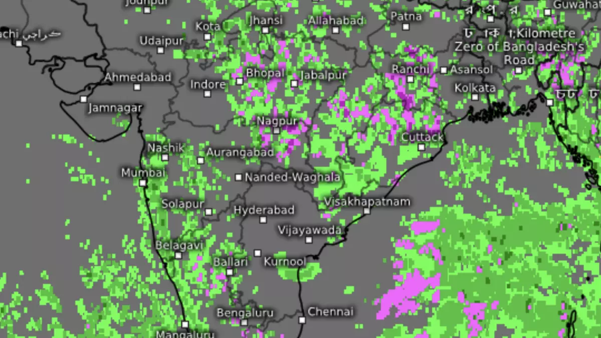
On Monday, the monsoon trough ran down from cyclonic circulation over North-West Madhya Pradesh (southward to its normal) to West-Central Bay off North Coastal Andhra Pradesh across East Madhya Pradesh, Vidarbha and South Chhattisgarh. This has been bringing widespread rain over Central India and adjoining East India which fall under its footprint.
The short to mid-term outlook (next seven days) spoke about the possibility of light to moderate fairly widespread to widespread rain, thunderstorms, and isolated heavy rain across many parts of the country. Scattered to fairly widespread light to moderate rainfall is likely over parts of East, North-East and Central India, Uttarakhand, Uttar Pradesh, Karnataka, Telangana, along the West Coast and the Lakshadweep and Andaman & Nicobar Islands.
South China Sea waves
The monsoon is now in the last month of September, but is getting a gentle push to the proceedings from incoming waves from the neighbouring South China Sea-West Pacific, which remain active. A few global models now suggest the good tidings may last right until the month-end. Contrary to forecasts, the withdrawal of the monsoon could get delayed in the process.
Some US models see a prominent monsoon tail lashing the eastern parts of the country vigorously during the next 10 days (until September 19 with very heavy rain over Uttar Pradesh, parts of Bihar and Jharkhand) followed by Mumbai-Konkan and adjoining West Maharashtra with an active to vigorous wet spell during the last 10 days (September 20 to 29).
