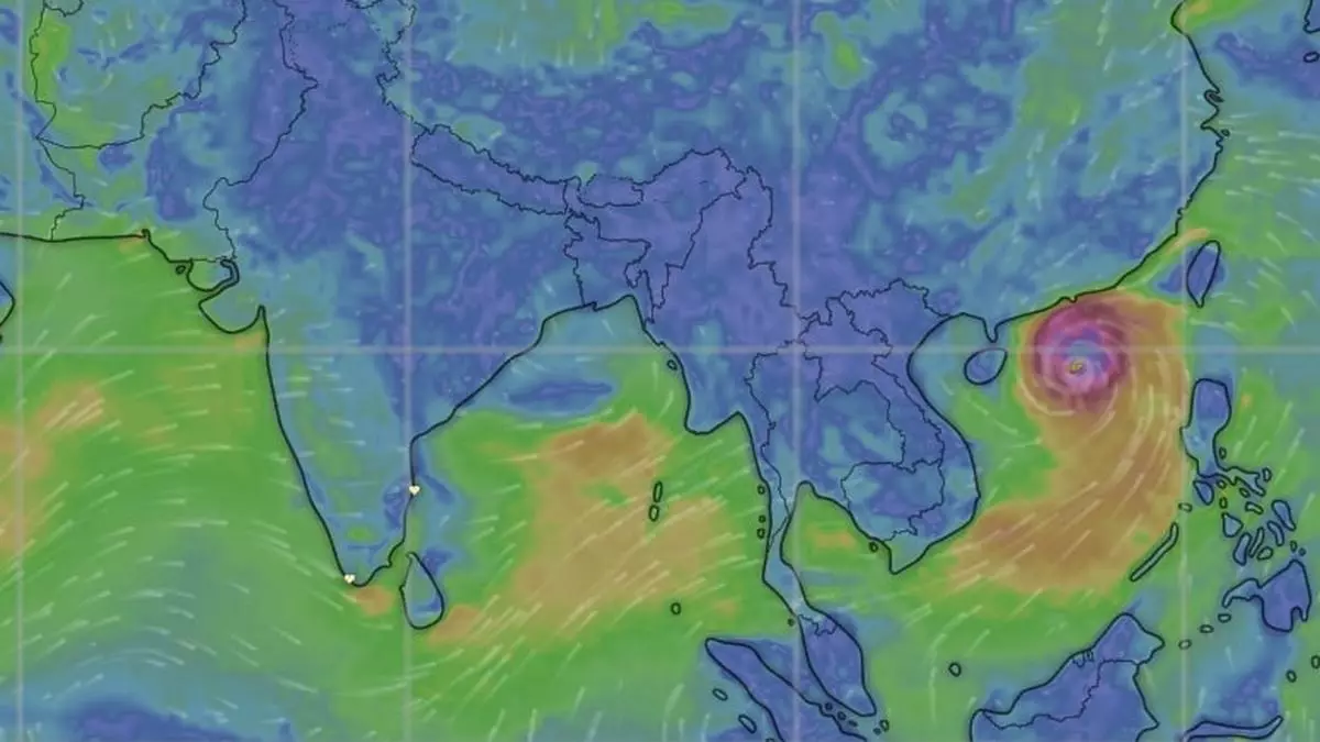
Fresh ‘low’ forms over Bay of Bengal as IMD warns of squally weather in both seas
A fresh low-pressure area formed over West-Central and adjoining North-West Bay of Bengal off the North Andhra Pradesh-South Odisha coasts on Thursday, and India Meteorological Department (IMD) put it on a slow burn on a track heading towards the warmest waters of North and North-East Bay during next two days.
A separate cyclonic circulation over North Andaman Sea that could wilt in view of the ‘big brother low’, or merge with it even as the West Pacific typhoon Yagi barrels towards Vietnam coast for a landfall and sends out a ‘pulse’ into the Bay across Myanmar. This could likely strengthen the ‘low’ into a depression or a deep depression as it crosses land over West Bengal.
Squally weather likely
Numerical model predictions of the IMD indicate possibility of squally weather with wind speeds of 45-55 km/hr developing off Sri Lanka; most parts of South and Central Bay; along and off North Andhra Pradesh coast; and over the Andaman Sea from Friday. Wind speeds may escalate to 45-55 km/hr gusting to 65 km/hr over parts of Central and South Bay of Bengal.
Outlook for Friday said heavy to very heavy rainfall (12 cm+) will drench parts of Coastal Andhra Pradesh & Yanam; Telangana; Coastal Karnataka; Konkan & Goa; Madhya Maharashtra; and Gujarat as the ‘low’ drags in moisture from the Arabian Sea as well. Heavy to very heavy rainfall is also likely over parts of Uttarakhand and East Rajasthan while being heavy (7 cm+) over parts of East Uttar Pradesh; West Rajasthan; Chhattisgarh; Bihar; Odisha; West Madhya Pradesh; and over North-East India as an incoming western disturbance meets monsoon easterlies over North-West India.
Alien trough over North
The core trough over land, or the monsoon backbone, passed through Suratgarh (Rajasthan); Rohtak; Orai (Uttar Pradesh) and Mandla (Madhya Pradesh) on Thursday before culminating in the ‘low’ and further extending into the East-Central Bay. Separately, an east-west trough ran down from a cyclonic circulation associated with the western disturbance over North-West Uttar Pradesh and adjoining Haryana, extending to Manipur across East Uttar Pradesh, Bihar and the hills of West Bengal.
On mend over North-West?
An alien trough is precursor of a weakening monsoon circulation over North-West India despite triggering rain from extra-monsoonal features. The IMD has forecast isolated very heavy rain over Uttarakhand on Friday; and East Rajasthan on Friday and Saturday. Isolated heavy rain is likely over Uttarakhand on both these days; East Uttar Pradesh on Friday; West Rajasthan on Friday and Saturday; and over East Rajasthan until Monday. Over North-East India and East India, isolated very heavy rainfall is forecast variously during these days.
