Fourth depression of the season likely to pop up over Bay by Monday
The Bay of Bengal is preparing to host the fourth storm of at least depression strength so far during the North-East monsoon (after cyclones Tej, Hamoon and Midhili) with India Meteorological Department hinting at the possibility of a rudimentary cyclonic circulation emerging over the South Andaman Sea and neighbourhood by Saturday with prospects of intensification.
The IMD said the circulation would lay the ground for the formation of a low-pressure area by Sunday itself. It is likely to move West-North-West initially and intensify into a depression over the South-East Bay of Bengal and adjoining Andaman Sea by Monday. Arrival of a helpful Madden-Julian Oscillation (MJO) wave could likely scale up the intensity further as the system guides itself along the tract of immediate predecessor Midhili, away from the Indian coast, and headed towards Bangladesh.
Helpful MJO wave in
If the short-to-medium outlook would have it, the Bay would have yet another depression/cyclone taking shape by the end of the month at a comparably lower latitude that could put itself in for a shy at the Sri Lanka or Tamil Nadu coast. But this would require to be supported with further ground-level confirmation over a period of the next week or so. The US Climate Prediction Centre has put the entire Bay basin under watch into the second week of December for enhanced weather activity.
Elsewhere to the north of the country, a fresh western disturbance is likely to affect North-West and West India from Saturday. It is likely to interact with lower-level easterlies from the Bay and trigger light to moderate rainfall at many places over Madhya Maharashtra, North Konkan, Gujarat, South-West Madhya Pradesh and south Rajasthan accompanied with isolated thunderstorms until Monday with maximum activity on Sunday. Light rainfall is also likely at isolated places over the hills and plains of Northwest India on Sunday and Monday.
Western disturbance play
businessline had given an indication to this possibility almost a week ago in a report https://www.thehindubusinessline.com/economy/agri-business/bay-bristling-with-fresh-cyclone-threat-bangladesh-on-firing-line-again/article67540312.ece. International weather models say the busy weather over the South Peninsula may lift during the first two weeks of December before becoming active again during the last week of the year.
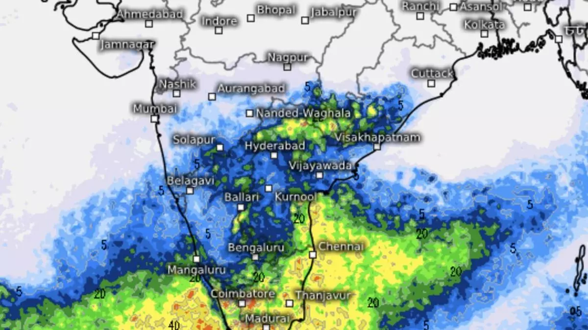
Meanwhile, easterly waves and assorted cyclonic circulations or troughs have kept the North-East monsoon kicking over parts of Tamil Nadu and Kerala. A circulation lay over interior Tamil Nadu and adjoining Kerala on Wednesday. It will cause light to moderate rainfall at many places and isolated heavy rain over Tamil Nadu and Kerala and Mahe until Friday and over South Interior Karnataka on Thursday and Friday. Isolated very heavy rainfall was forecast over interior Tamil Nadu and Kerala on Wednesday.
Next Bay system
Outlook for November 30 and December 1 said scattered to fairly widespread light to moderate rainfall is likely over parts of the South peninsula, along the West Coast, Maharashtra and the Andaman & Nicobar and Lakshadweep Islands. This more or less corresponds with the time of a probable fifth strong weather system developing over the southern parts of the Bay eyeing Sri Lanka/Tamil Nadu as indicated by early signals. This, as said earlier, would need to be corroborated with evolving conditions over the Bay and the South China Sea which would continue to fancy their chances under the overarching MJO wave influence.
