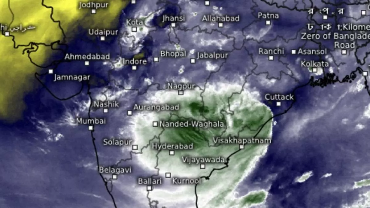
Extreme heavy rain for Coastal AP, Telangana, Odisha today as deep depression lurks
A deep depression, second only to a tropical cyclone in strength and intensity, was unmoved from Sunday’s location over north-west and adjoining west-central Bay of Bengal as it lurked 70 km south-east of Puri (Odisha); 140 km east of Gopalpur (Odisha); 120 km south-south-west of Paradip and 170 km south-southwest of Chandbali (Odisha); 240 km east- north-east of Kalingapatnam (Andhra Pradesh); and 290 km south-southwest of Digha (West Bengal) on Monday morning.
To cross Puri coast
Being closest to Odisha coast, the deep depression is likely to move nearly northwestwards and cross its coast near Puri by Monday noon. Thereafter, it will shift track to west-northwest while meandering across Odisha & Chhattisgarh during next two days. Rapid intensification to twice the level originally forecast, the deep depression will manage to cut short its intended stay of 2-3 days over the waters towards West Bengal coast, and instead sniff out the closest coast (Odisha) for early landfall.
Bay waters warm up further
North and north-west Bay had warmed up by a degree in the interregnum to 30 ℃ aiding the intensification, cut short only by high wind shear values (sudden change in wind speed and direction with height), which are usual during the monsoon. The high shear values do not allow a proper ‘storm tower’ to develop and anchor the system. According to global model analysis, shear values over the north-west and adjoining north Bay show a tendency go higher up in the next few days.
Monsoon trough position
The monsoon trough, which anchors the rain system over north-west India and the Indo-Gangetic plains, continued to be to south of its normal position and stay as such for next 3-4 days, setting off active monsoon conditions over west central and south peninsular India at the expense of north-west, where a lone cyclonic circulation stood in vigil over central Rajasthan.
Extreme heavy rain
In view of deep depression, India Meteorological Department (IMD) has predicted isolated extremely heavy rainfall over Coastal Andhra Pradesh & Yanam and Telangana on Monday. It will be isolated heavy over Telangana, South Interior Karnataka, Kerala & Mahe on Monday and Tuesday; Coastal Andhra Pradesh & Yanam until Thursday; and Coastal Karnataka until Wednesday.
To spear out to east
Proximity to the system will bring isolated extremely heavy rain to Odisha as well on Monday. Isolated very heavy rainfall is likely over Jharkhand on Tuesday and Wednesday; plains of West Bengal on Monday; Assam & Meghalaya on Wednesday and Thursday; and Nagaland, Manipur, Mizoram & Tripura from Tuesday to Thursday. Isolated heavy rain is likely over Nagaland, Manipur, Mizoram & Tripura during next seven days; Assam & Meghalaya until Friday; Odisha until Tuesday; Arunachal Pradesh from Tuesday to Thursday; plains of West Bengal on Monday and Tuesday; hills of West Bengal & Sikkim until Thursday; Bihar from Thursday to Saturday; and Jharkhand until Thursday.
West and central India
Over west and central India, Isolated very heavy rainfall is likely over West Madhya Pradesh on Wednesday and Thursday; East Madhya Pradesh on Monday and Tuesday; Chhattisgarh until Tuesday; and Vidarbha on Monday. It will be isolated heavy over West Madhya Pradesh until Thursday; East Madhya Pradesh on Monday and Tuesday; Gujarat Region (North Gujarat, Gandhinagar and South Gujarat); Konkan & Goa; Vidarbha; and Chhattisgarh until Wednesday; and Madhya Maharashtra until Thursday.
Heavy over north-west
Over north-west India, isolated very heavy rain is likely over East Rajasthan on Thursday and Friday; isolated heavy over Uttar Pradesh from Tuesday to Thursday; Haryana and West Rajasthan on Monday; Uttarakhand until Saturday; East Uttar Pradesh on Tuesday and Wednesday; East Rajasthan on Monday and Friday. The rains here will happen as a remnant of the deep depression makes it bold to push and scare away the invading drier north-westerly winds associated with monsoon withdrawal.
