Early Sept surge pares rainfall deficit to single-digits, more forecast
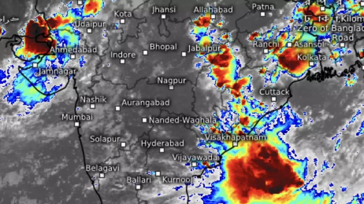
A monsoon surge on view so far during the first half of September has delivered to the hilt over Central India, helping pare down all-India rain deficit to eight per cent as on Sunday from a seasonal high of 11 per cent till a week ago, while global model forecasts indicated even more rain to come during the second half the month, also the last of the monsoon season.
The high September numbers are likely due to a late-blooming positive Indian Ocean Dipole (IOD) phase, nearer-home cousin of El Niño-La Nina over Equatorial and East Pacific, that impacts an ongoing Indian monsoon. Sea-level pressure lowers while surface temperatures look up over the western basin of the Indian Ocean (covering South-East Arabian and Laccadive seas) compared to the East (adjacent to East Bay of Bengal) during this phase, boosting moisture carry and cloud formation.
Fresh ‘low’ forecast
The elevated rain phase could extend to the rest of the month and even into early October, according to most model forecasts. September has already seen a couple of helpful low-pressure areas at work as usual, but India Meteorological Department (IMD) has indicated a third may be rearing over the Bay during the next two days. This comes close on the heels of the productive run of a predecessor that has just weakened over East Rajasthan, upsetting the normal monsoon withdrawal schedule.
The rest of the month is likely to see above-normal rain over parts of North-West India and adjoining West India (East Rajasthan, West Madhya Pradesh and Gujarat) until September 25, followed by strengthening of the monsoon current along the West Coast. This is expected to deliver normal to surplus rain over Peninsular India and adjoining South Peninsula. States of Maharashtra, Andhra Pradesh, Telangana, Karnataka, Tamil Nadu and Kerala may variously benefit during this phase.
Delayed withdrawal?
A short-term outlook of the IMD said light to moderate fairly widespread to widespread rain, thunderstorms, lightning and isolated heavy to very heavy rain is likely over eastern parts of Gujarat and South Rajasthan on Monday and Tuesday and over North Konkan and North Madhya Maharashtra on Monday. Isolated extremely heavy rain is likely over western parts of Gujarat state on Monday; very heavy rain on Tuesday; and very heavy rain over South Rajasthan on Monday.
As for North-West India, light to moderate scattered to fairly widespread rains, thunderstorms and isolated heavy falls are likely over the Jammu division and Himachal Pradesh on Monday. Over East India, light to moderate fairly widespread to widespread rains, thunderstorms and lightning with isolated heavy rain is likely over the plains of West Bengal, Sikkim and Jharkhand from Wednesday to Friday; over plains of West Bengal on Thursday and Friday; over Odisha from Monday to Thursday; and over Bihar on Thursday and Friday. Isolated very heavy rainfall is likely over Odisha on Wednesday and Thursday.
