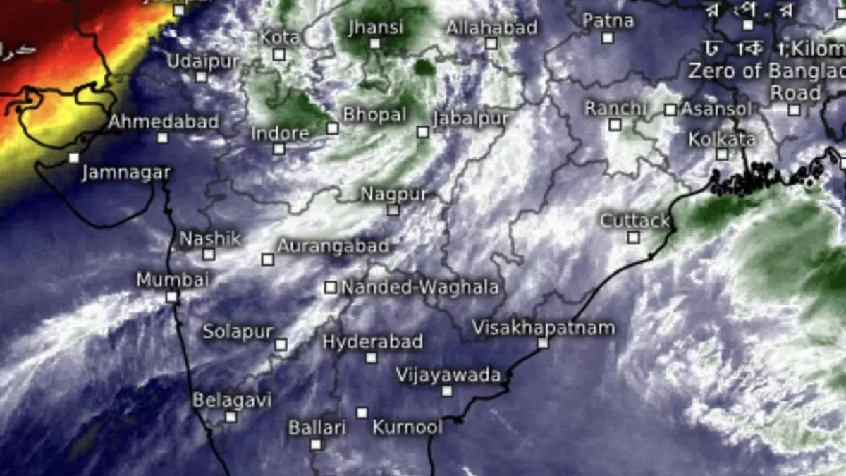
Depression set for comeback over Madhya Pradesh as extreme heavy alert goes live again
The well-marked low-pressure area over North-East Madhya Pradesh is expected to intensify back into a monsoon depression in a hectic 360º turn of weather events – a rare spectacle during the closing stage of the monsoon – panning out over west and central India on Wednesday as the rainy season negotiated the penultimate week of September.
The well-marked ‘low’ itself had weakened from being depression in the first place, which it turn owes it origins to a deep depression – and second only in strength and intensity to a cyclone – that had crossed the Odisha coast early on Wednesday morning.
Extreme heavy rain
India Meteorological Department (IMD) has predicted isolated extremely heavy rain over West Madhya Pradesh on Wednesday. Isolated very heavy rain is likely over Vidarbha the same day; and over entire state of Madhya Pradesh until Saturday that may sustain for next seven days.
Isolated very heavy rain has also been forecast for Konkan & Goa; ghats of Madhya Maharashtra; Gujarat Region (North Gujarat, Gandhinagar and South Gujarat); and Chhattisgarh, from Saturday to Tuesday next.
Heavy rain for Uttarakhand
A granular outlook said heavy to very heavy rain (12 cm+) with extremely heavy falls (20 cm+) may break out over West Madhya Pradesh, while it would be heavy to very heavy over Uttarakhand; Uttar Pradesh; East Rajasthan; Vidarbha; and East Madhya Pradesh; heavy (7 cm+) over Assam & Meghalaya; Nagaland; Manipur; Mizoram; Tripura; Konkan & Goa; ghats of Madhya Maharashtra; Gujarat Region, Coastal and South Interior Karnataka, Uttarakhand and Haryana-Chandigarh-Delhi.
Major troughs in place
Elsewhere, the backbone monsoon trough continues to be active and south of its normal position, and will continue to do so for next 3-4 days.
It passes through Bikaner; Kota; Guna; centre of well-marked ‘low’ pressure area; Ambikapur; Jamshedpur; Digha, and southeastwards into the central Bay.
Trough alignment with eastern end dipping into the Bay waters supports the monsoon. A cyclonic circulation lies over south Gujarat from where the off-shore trough lay extended to central Kerala. These apart, an incoming western disturbance lies as a trough over east-central Pakistan.
East and northeast
To the east and northeast, isolated extremely heavy rain is likely over Tripura, Mizoram and south Manipur on Friday.
It will be isolated very heavy over Assam & Meghalaya on Friday and Saturday; south Mizoram on Thursday; Isolated heavy over Assam & Meghalaya during next six days; Arunachal Pradesh from Friday to Tuesday; Nagaland, Manipur, Mizoram, West Bengal, Sikkim, Odisha, Bihar and Tripura until Saturday; and Jharkhand on Friday and Saturday.
