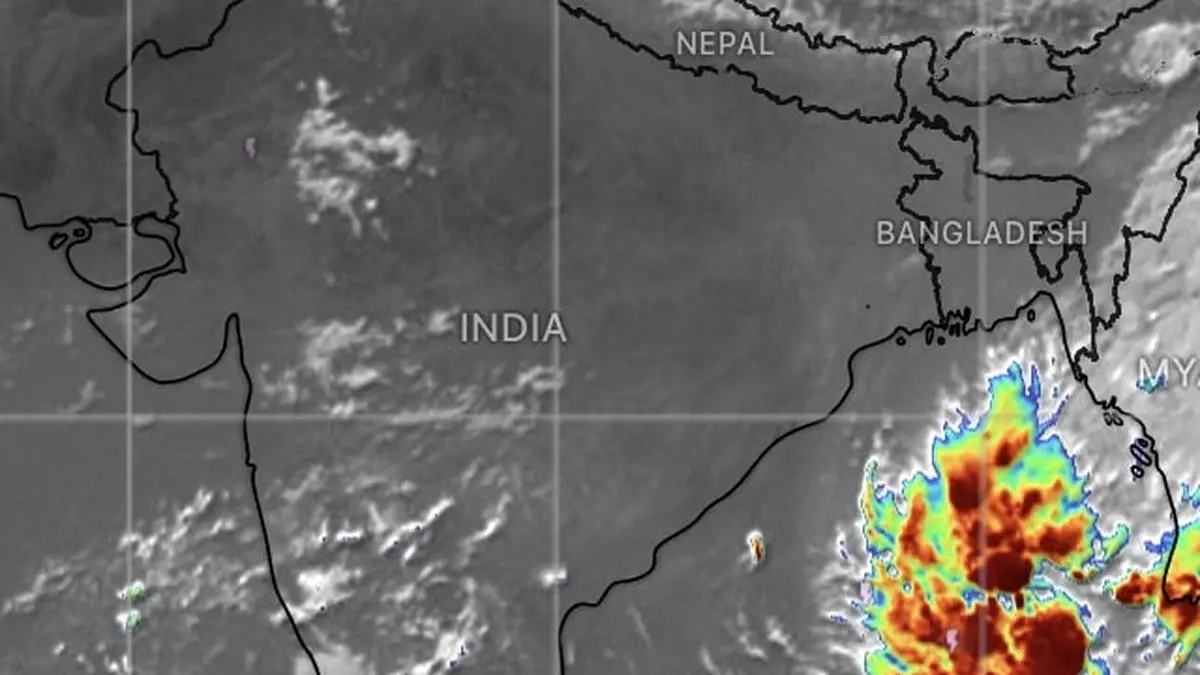
Depression forms over east-central Bay, to ramp up as cyclone Dana on Wednesday
Monday’s well-marked low-pressure area over east-central Bay of Bengal moved west-north-west and concentrated into a monsoon depression over the same region on Tuesday morning, about 730 km south-east of Paradip (Odisha); 770 km south-south-east of Sagar Island (West Bengal); and 740 km south-south-east of Khepupara (Bangladesh).
Cyclone Dana soon
The depression may continue to move west-north-west and intensify into cyclone with the moniker Dana by Wednesday while being practically unchanged from its bearings on Tuesday.
It may shift track to north-west and intensify as a severe cyclone over adjoining north-west Bay by Thursday morning and cross north Odisha and West Bengal between Puri and Sagar Island during the intervening night of Thursday and Friday as a severe cyclone with wind speeds of 100-110 km/hr gusting 120 km/hr.
Fishermen alert issued
India Meteorological Department (IMD) has advised fishermen not to venture into the west-central Bay on Wednesday and Thursday; and north Bay of Bengal and coastal waters along and off Odisha, West Bengal and Bangladesh coasts from Wednesday to Friday.
Sea conditions are forecast to be ‘rough’ (wave heights of 8-11 ft) to ‘very rough’ (13-20 ft) to ‘high’ (20-30 ft) on these days and may improve from Friday afternoon only.
Rain outlook for Odisha
The IMD has forecast light to moderate rain is likely at most places over Balasore, Bhadrak, Kendrapara, Jagatsingpur, Puri, Khorda, Ganjam and Gajapati districts of Odisha on Wednesday with heavy rain (07-11 cm) at isolated places and heavy to very heavy rain at a few places.
Extremely heavy rain (greater than or equal to 21 cm) may lash isolated places over Baleswar, Mayurbhanj, Bhadrak, Kendrapara, Jagatsingpur, Kendujhar, Jajpur, Cuttack, Dhenkanal and Puri districts on Thursday and Friday.
Bengal, north Andhra outlook
Over West Bengal, light to moderate rain is likely at most places with heavy rainfall at isolated places is likely on Wednesday over the districts over South and North 24 Parganas; East and West Medinipur; Jhargram; Howrah; Hooghly; Kolkata; and Bankura.
It will be heavy to very heavy at a few places with extremely heavy rain at isolated places over the plains of West Bengal. Elsewhere, moderate rain is forecast at isolated places over Srikakulam, Vizinagramm and Visakhapatnam districts of north Andhra Pradesh on these days, while being heavy at isolated places., as the cyclone moves to east-north-east.