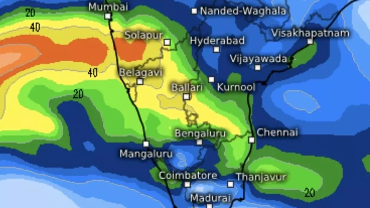
Depression crosses coast and weakens, lowering rain intensity over Tamil Nadu, south coastal Andhra Pradesh
A rain-driving monsoon depression over the west-central and adjoining south-west Bay of Bengal crossed the north Tamil Nadu-South Andhra Pradesh coasts early on Thursday morning between Puducherry and Nellore, close to the north of Chennai. It has since weakened into a well-marked low-pressure area over south coastal Andhra Pradesh and adjoining north coastal Tamil Nadu.
It may move to the west-northwestwards and weaken further into a low-pressure area towards the evening. The India Meteorological Department (IMD) has forecast light to moderate rain at many places over Tamil Nadu, Puducherry, and Karaikal on both Thursday and Friday, interspersed with isolated heavy rain.
Isolated heavy rain
Light to moderate rain has been predicted on the same day at most places over south coastal Andhra Pradesh and Rayalaseema, with heavy rain at isolated places. It is expected to be light to moderate at most places over Kerala on Thursday, with heavy rain at isolated places. Mostly similar conditions have been forecast for south Interior Karnataka as well on both Thursday and Friday.
Fresh system seen
The well-marked ‘low’ is seen travelling west-northwest across the peninsula and entering the Arabian Sea off Goa, rather than moving towards the north Kerala-coastal Karnataka as expected earlier. It will leave a trail extending back into the southeast Bay, where another cyclonic circulation/low-pressure area may develop, with a track away from the Tamil Nadu and south Andhra Pradesh coasts.
Wet climates may improve
The system is shown heading north towards the Odisha coast and later into adjoining West Bengal, leaving the larger Bay like a ghost town with nil activity. Weak easterlies to north-easterlies are shown to prevail over the south peninsula during the next week, ending Saturday (October 26), when forecasts are available, with a marked reduction in rain activity.
Longer term outlook
Climate Forecast System (CFS) model suggests that the lull may last longer and that organised rain may not revive over south peninsula until November 15. In the meantime, however, activity may get triggered over the extreme southeast Bay and the adjoining Gulf of Thailand, though its propagation dynamics, intensity and direction need to be watched. Separately, the US Climate Prediction Center sees a possibility of thundershowers breaking out afresh over the extreme south peninsula by the end of October or early November.
