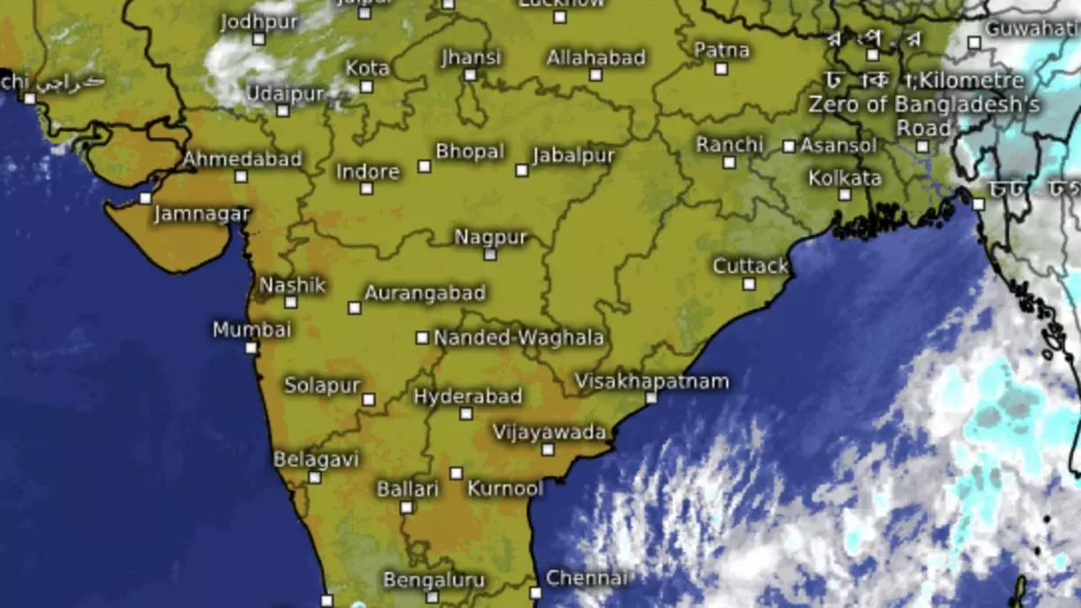
Cyclone Midhili swamps Bangla coast, fails to quieten down Bay of Bengal
Cyclone Midhili over the North-West and adjoining North-East Bay of Bengal started crossing the Bangladesh coast on Friday evening close to Khepupara with wind speeds of 65-75 km/hr gusting to 85 km/hr, an India Meteorological Department (IMD) update said at 4.45 pm. The landfall process was expected to be completed during a three-hour period into the night.
Midhili ended up as the weakest of the three cyclones generated over the North Indian Ocean (the Arabian Sea and the Bay of Bengal combined) during the ongoing North-East season after extremely cyclone Tej in the Arabian Sea and very severe cyclone Hamoon in the Bay earlier in October. The latest cyclone didn’t appear to have quietened down the Bay appreciably with the IMD sounding out out an easterly wave alert and associated wet spell for Kerala and Tamil Nadu early next week.
More rain for Kerala, TN
The IMD said an easterly wave is likely to cause isolated heavy rain spell over Tamil Nadu and Kerala on Monday and Tuesday. A short to medium term outlook said the buzz in the Bay will stay elevated into the third and fourth weeks of November with at least one more rain-generating circulation or low-pressure area popping up during the period. businessline had provided some indications in an October 27 report, https://www.thehindubusinessline.com/economy/agri-business/n-e-monsoon-gaining-strength-may-stay-active-into-november-first-week/article67465914.ece.
Outlook for December
A few global models continue to predict normal to above normal rain not just during December but also during the first four months of the New Year (January, February, March and April) except over parts of North-East India. The US Climate Forecast System is convinced of the favourable implications for entire India during December while an early outlook from Busan, South Korea-based APEC Climate Centre sees a similar weather pattern extending into the first few months of the New Year as well.
Detailed outlook from the South Korean model suggests normal to above-normal rainfall for the South Peninsula during December, the last of the three North-Eastern monsoon months. Its deterministic MME model says above-normal rainfall is likely for Tamil Nadu, Kerala, Coastal Karnataka and Goa. The probabilistic MME model is however not as convinced and limits the above-normal rain to over southern parts of Kerala and Tamil Nadu, and just about normal rain for the rest of the region.
Varying El Nino predictions
As for January 2024, the first of the two South Korean models suggest normal to slightly above-normal rain for the entire South Peninsula, while the second signals largely climatological (historical) pattern to prevail during the first month of the New Year. February is likely to see weather ranging from dry (rain deficit) to normal showers over South Kerala and adjoining Tamil Nadu. The dry patch extends to more parts during spring in March, while the odd forecast suggests normal rain pattern prevailing.
Outlook for the core summer months of April and May does not drastically change from that indicated for March, although the forecast accuracy for spring and pre-monsoon months (2024) would be suspect due to influence from large global climatic events such as the El Nino/La Nina pattern in the Equatorial Pacific, a last word on which is awaited. Some models see a ‘neutral’ Pacific emerging during the period while others have called out for current El Nino conditions to persist into the next summer.
