Brewing depression may hold back monsoon withdrawal process briefly
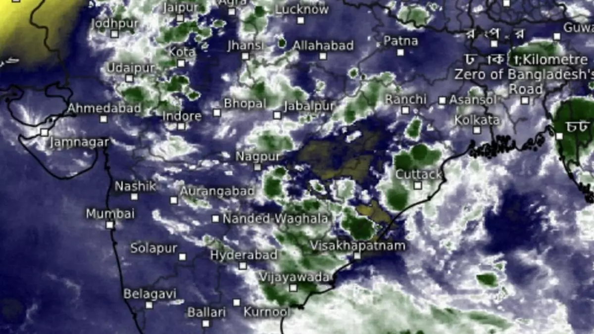
Monsoon withdrawal from north-west India may get delayed beyond the revised September 17 timeline in view of likely intensification of a low-pressure area into a depression over North-West Bay and adjoining West Bengal, north Odisha, and Bangladesh coasts, and its subsequent slow onward movement over land towards east and central India.
India Meteorological Department (IMD) said it may weaken after crossing the land along West Bengal coast by September 12, but may regain some strength while tracking West-North-West over land. The IMD saw the system baulk at the invading drier north-westerlies associated with monsoon withdrawal over East Madhya Pradesh-Vidarbha at least until September 15.
Super typhoon Yagi
Meanwhile on Friday, powerful super typhoon Yagi in the North-West Pacific erupted in a calamitous landfall over the Hainan Island to the south-west of China, and was headed towards Vietnam next. After landfall here, a remnant is expected travel across Laos, Thailand and Myanmar to enter the Bay where it will merge with the lingering ‘low’ and help with its intensification.
Back home, the core monsoon trough passed through Bikaner (Rajasthan); Narnaul (Haryana); Sidhi (Madhya Pradesh); and Sambalpur (Odisha) before encountering the ‘low’ over the Bay of Bengal. After a break, a non-monsoon secondary trough has re-emerged, as it ran down from south-east Uttar Pradesh across north Chhattisgarh and north Odisha towards the ‘low.’
Heavy rain for North-East
The depression will initially hit east and north-east India, given the close proximity. Isolated very heavy rain is likely over Assam and Meghalaya; Nagaland; Manipur, Mizoram; and Tripura from Monday to Thursday; over Odisha on Sunday and Monday. It will be isolated heavy over Assam and Meghalaya and Nagaland, Manipur, Mizoram & Tripura for next seven days; over Odisha and Jharkhand until Tuesday; Bihar on Saturday; hills of West Bengal & Sikkim on Monday and Tuesday; over West Bengal until Thursday; and Arunachal Pradesh from Tuesday to Thursday.
Central India outlook
Over central India, isolated very heavy rain is likely over Gujarat Region (North Gujarat, Gandhinagar and South Gujarat) on Saturday; and ghat areas of Madhya Maharashtra, Konkan & Goa until Monday. Isolated heavy rain is likely over Chhattisgarh during next seven days; Saurashtra & Kutch on Saturday; West Madhya Pradesh; Gujarat Region; and east Madhya Pradesh variously until Thursday; Konkan & Goa and ghats until Wednesday; and Vidarbha from Sunday to Wednesday.
More rain for AP, Telangana
Isolated very heavy rain is likely over coastal Andhra Pradesh and Yanam on Sunday and Monday; and Telangana on Monday and Tuesday. It will be isolated heavy over Kerala and Mahe; Coastal Andhra Pradesh and Yanam; and Coastal Karnataka and Telangana until Tuesday. Over north-west, it will be isolated very heavy over east Rajasthan on Saturday, and isolated heavy over Uttarakhand the same day; over east Uttar Pradesh on Monday and Tuesday; south-west Rajasthan on Saturday; and east Rajasthan until Sunday.
