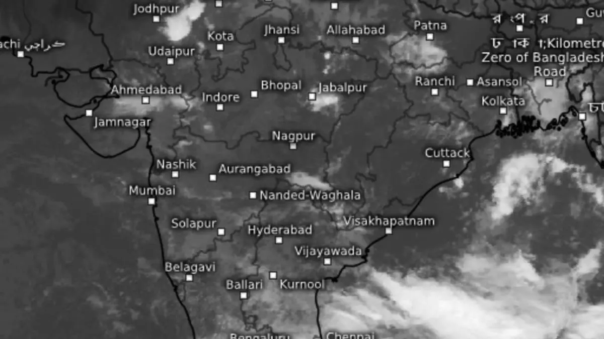
Bay ‘low’ to intensify as depression under watch of super typhoon Yagi over South China Sea
India Meteorological Department (IMD) has confirmed the outlook for Thursday’s low-pressure area to intensify into a depression during its prolonged stay over the West-Central and progressively North-West Bay of Bengal waters off the Odisha, West Bengal and Bangladesh coasts over next few days.
Super typhoon Yagi
Evolution as a depression is expected to happen under the watch of the many-times-more powerful super typhoon Yagi approaching South-West China coast, Hainan and Vietnam for multiple landfalls. Yagi shares the same but disproportionately large share of monsoonal flows as the brewing Bay depression, thanks to size and intensity. The super typhoon currently has grown to the equivalent of a Category-4 storm on the five-step Saffir-Simpson scale for hurricane intensity in the Atlantic.
Active monsoon trough
A ‘pulse’ from the powerful storm is expected to drift onward into the Bay, likely intensifying it later. Meanwhile, the IMD said on Friday morning the core monsoon trough over land remains active with its western end near its normal position and eastern end lying south of its normal position for next 2-3 days, signalling intense monsoon conditions over East and North-East India. It will continue to stay as such so for another 2-3 more days, with intensification as depression expected to follow.
The core monsoon trough over land passed through Bikaner and Kota in Rajasthan; Guna; and Jabalpur in Madhya Pradesh before cutting through the ‘low’ over the Bay waters and culminating in the East-Central Bay. Thursday’s alien (secondary)trough from the cyclonic circulation over North-West Uttar Pradesh and running down to Manipur across East Uttar Pradesh and the hills has weakened as monsoon south-easterlies from the Bay ‘low’ began to wad into the region.
Heavy to very heavy rain
Heavy to very heavy rain (12 cm+) is forecast over North-West India across Uttarakhand and East Rajasthan thanks to the cyclonic circulation over North-West Uttar Pradesh and adjoining Haryana as it drags moist southerlies from the North Arabian Sea, backed up by a western disturbance in the form of a cyclonic circulation located over Jammu and adjoining Pakistan.
Heavy rain(7 cm+) is predicted to materialise over parts of East Uttar Pradesh; West Rajasthan; Chhattisgarh; Bihar; Odisha; West Madhya Pradesh; North-East India; Konkan & Goa; Madhya Maharashtra; Gujarat; Coastal Andhra Pradesh & Yanam; Telangana; and Coastal Karnataka, under the influence of flows from the Arabian Sea as well as those from the ‘low’ over the Bay.
Squally weather warned
The IMD has retained warning of squally weather with wind speeds of 35-45 km/hr developing off Sri Lanka coast; over most parts of South and Central Bay; along and off the North Andhra Pradesh coast; and the Andaman Sea, on Friday. Many parts of upstream Arabian Sea may also witness similar conditions. Fishermen have been advised not to venture into these areas. Wind speeds may reach 45-55 km/hr gusting to 65 km/hr over parts of Central and South Bay as well as parts of the Arabian Sea.
