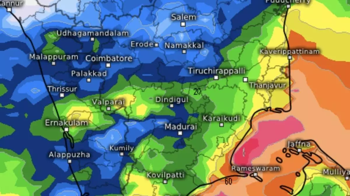
Heavy rain headed for parts of Kerala as well-marked ‘low’ enters Gulf of Mannar
A well-marked low-pressure area over south-west Bay of Bengal off Sri Lanka has checked into the Gulf of Mannar on Thursday morning. It is likely to continue to move west-northwest towards South Tamil Nadu and weaken gradually. Towards the north, from the opposite side, a fresh western disturbance as a trough approached extreme west Rajasthan the same morning.
Heavy to very heavy rain (+/-20 cm) is forecast on Friday at isolated places over Kerala & Mahe while it will be heavy at isolated places over Andaman & Nicobar Islands, Tamil Nadu, Puducherry & Karaikal and Lakshadweep, according to an India Meteorological Department (IMD) update on Thursday.
Next rain wave
Tamil Nadu, Puducherry & Karaikal will receive isolated heavy rain on Friday as also on Monday and Tuesday next in what is an indication of a new rain wave approaching the coast early next week. The wave will originate from Andaman & Nicobar Islands where heavy rain is forecast for three days from Friday.
Heavy to very heavy rain is likely at isolated places over Tamil Nadu, Puducherry & Karaikal on Tuesday and isolated heavy rain on Friday, Monday and Wednesday. Kerala & Mahe, coastal Andhra Pradesh and Rayalaseema too will witness isolated heavy rain on Tuesday and Wednesday. Heavy rain forecast for South Interior Karnataka on Tuesday and over Lakshadweep, on Friday.
Squally weather likely
Squally weather with wind speeds ranging from 35- to 45 km/hr gusting to 55 km/hr may prevail along and off Kerala coast, Lakshadweep area, the Comorin, Gulf of Mannar, and along and off Tamil Nadu coast on Friday. Fishermen are advised not to venture into these areas.
On Saturday, these conditions may develop over the Andaman & Nicobar Islands as projected next rain wave gets expedited with accompaniment of heavy rain. Squally weather with wind speeds of 35-45 km/hr and gusting to 55 km/hr may prevail over Lakshadweep area off Kerala coast, Comorin, Gulf of Mannar and south Andaman Sea. Fishermen are advised caution.
- Also read: Fresh ‘low’ on Fengal’s trail, to bring more rain to coastal Tamil Nadu, Andhra Pradesh next week
Western disturbance
Passage of the western disturbance may bring a cold wave on its tail for next five days over isolated pockets over Rajasthan ; some parts of Punjab; and in isolated pockets of Haryana-Chandigarh, Uttar Pradesh and Madhya Pradesh; over Saurashtra & Kutch on Thursday; over Delhi on Thursday and Friday; and Jammu-Kashmir-Ladakh for four days from Friday.
Onward forecast
Latest update from the US Climate Forecast System model suggest a normal rain outlook would remain from December 21 to 30 and early into January, 2025 (New Year). Enhanced rain belt may migrate to north India from January 10 across North-West India, Central India and East and North-East India.
Rain and cloud cover is forecast during this period over the meteorological subdivisions of East and West Rajasthan; Gujarat; Saurashtra & Kutch; Jammu & Kashmir & Ladakh; Himachal Pradesh; Uttarakhand; Punjab, Haryana & Delhi; Uttar Pradesh; Bihar; Jharkhand; West Bengal; Chhattisgarh; Odisha; East Madhya Pradesh; and Vidarbha.
