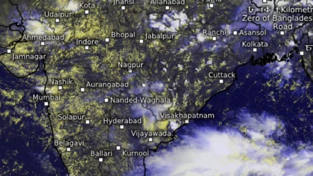
Heavy rains lash parts of AP, Chhattisgarh as clouds deepen over adjoining Bay of Bengal
Heavy rain lashed parts of West Rajasthan and Himachal Pradesh on Wednesday under the influence of a resident cyclonic circulation (remnant of erstwhile low-pressure area) located over central Rajasthan. At the same time, the India Meteorological Department (IMD) retained the watch for a fresh ‘low’ over the Bay of Bengal.
The morning after, a preparatory cyclonic circulation lay spreadeagled over Coastal Andhra Pradesh and adjoining West-Central Bay. It is expected to stay put there for the next 2-3 days, as already predicted in these columns. A monsoon shear zone, where opposing wind regimes meet, also called monsoon playground, runs to the north of Nellore in Coastal Andhra Pradesh. The cyclonic circulation is expected to descend to lower levels and settle as a ‘low’ during the day.
Heavy rain forecast
The IMD has forecast heavy to very heavy rainfall (12 cm+) over coastal Andhra Pradesh, Yanam, and Telangana and heavy rain (7 cm+) over Uttarakhand, Uttar Pradesh, Rajasthan, East Madhya Pradesh, Chhattisgarh, hills of West Bengal & Sikkim, Bihar, Odisha, North-East India, and to the west over Konkan, Goa, Gujarat, and Karnataka. Isolated very heavy rain is also likely over Coastal Andhra Pradesh, Yanam, and Telangana. The indication is that rain has started lashing parts of Andhra Pradesh.
Central, West India rains
Isolated heavy rain is forecast for Coastal Andhra Pradesh & Yanam, and Telangana on Thursday; over Coastal Karnataka and North Interior Karnataka until Sunday; South Interior Karnataka until Saturday; and over Kerala & Mahe from Sunday to Tuesday. It will be fairly widespread to moderate over West and Central India during the week with isolated heavy rain over Chhattisgarh; East Madhya Pradesh and Saurashtra & Kutch on Thursday and Friday; Vidarbha on Tuesday next; and over Konkan & Goa; ghats Madhya Maharashtra and Gujarat Region (North Gujarat, Gandhinagar, South Gujarat) till Sunday.
Depression in making
Numerical weather predictions indicate the ‘low’ could intensify into a depression or a deep depression after an incoming ‘pulse’ from the West Pacific typhoon Yagi charges it up. In an outlook for Friday, the IMD has warned that squally weather will evolve with wind speeds of 35-45 km/hr along and off the North Andhra Pradesh coast and the Andaman Sea, as well as over parts of the Arabian Sea.
Read: Fresh low-pressure area to develop off AP-Odisha coasts in 2-3 days
The wind speeds may touch 45-55 km/hr, gusting to 65 km/hr (near-cyclonic) ph is likely over parts of Central and adjoining North-East and South-East Bay and parts of the Arabian Sea. Fishermen are advised not to venture into these areas.
