Rain may weaken over North-West India as IMD retains watch for fresh ‘low’ over Bay of Bengal
The rain-driving low-pressure area over the Vidarbha region has shifted north-west to South-East Rajasthan and adjoining South-West Madhya Pradesh on Wednesday, according to a morning update by the India Meteorological Department (IMD). It may weaken sooner in view of the development of a fresh low-pressure area over the seas off the Andhra Pradesh-Odisha coasts by Thursday.
The IMD’s numerical weather predictions show a remnant of brewing typhoon Yagi over the North-West Pacific checking into Vietnam by the weekend. An incoming pulse from it may merge with the ‘low’ in the Bay of Bengal. The IMD model (though facing glitches on Wednesday) delays the entry of the combined entity into the West Bengal coast not until Thursday next.
High-pressure area
As mentioned in these columns, the lack of a predominant low-pressure system that anchors incoming flows may allow a high-pressure area (ridge) to develop over North-West India. This will likely weaken monsoon activity over the region into next week. It will be left to the low-pressure area emerging from the Bay to hold back the advance of the ridge further inland.
The western end of the monsoon trough over land, its very backbone, has already shifted to near-normal position, signifying ‘de-escalation’ in rain activity over North-West India. The eastern end remains to the south of its normal position, indicating active monsoon conditions over that region, and throwing open the doors for an emerging low-pressure area from the Bay.
Heavy rain forecast
On Tuesday, the heaviest rainfall was reported from the Andaman & Nicobar Islands, with building clouds in anticipation of the ‘low’ firing down its contents. As for today (Wednesday), isolated very heavy rain is forecast for Gujarat Region (North Gujarat, Gandhinagar and South Gujarat). Isolated heavy rain is likely here and adjoining Konkan & Goa for a week, the IMD said.
A similar outlook holds for West Madhya Pradesh and Saurashtra and Kachch for next four days; East Madhya Pradesh for two days; Chhattisgarh for six days; and the ghats of Madhya Maharashtra for four days. It will be fairly widespread to widespread to isolated heavy over South Peninsular India, East and North-East India and North-West India variously during the week.
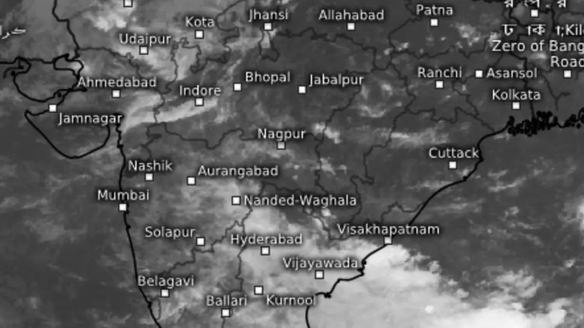
Satellite pictures
Satellite pictures at Wednesday noon showed rain clouds invading South Andhra Pradesh, Telangana, South Interior Maharashtra, Interior Tamil Nadu, and adjoining Karnataka. Another parcel of clouds drifted over the Gujarat Region, South-East and adjoining North Rajasthan, New Delhi, Chandigarh, and Punjab as a resident ‘low’ attracts weak south-westerly winds from the Arabian Sea.
