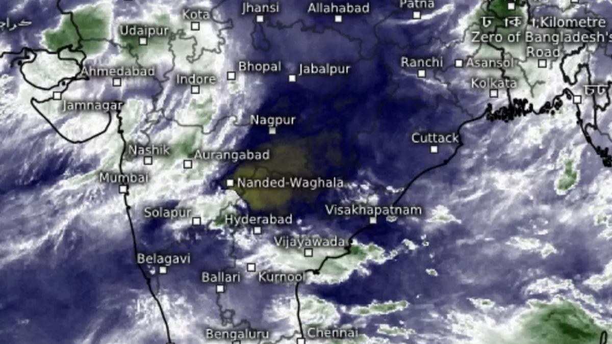
Heavy to very heavy rain expected in parts of Gujarat and West Madhya Pradesh today
Heavy to very heavy rainfall (>12 cm) with extremely heavy falls (>20 cm) may lash parts of Gujarat Region (North Gujarat, Gandhinagar and South Gujarat) on Tuesday as a slow-moving, often idling, depression weakened as a well-marked ‘low’ but persisted over the Vidarbha region. Slow lateral movement can often prolong the stay of a rain system over a region.
Another well-marked ‘low,’ remnant of erstwhile cyclone Asna, and located farther away out into the Arabian Sea, sent out a stream of south-westerlies towards its land-based counterpart even as the latter managed to attract moist south-easterly winds from the Bay of Bengal across the Andhra Pradesh coast. The IMD said the land-based system hold on for another day before weakening into a conventional ‘low.’
Heavy rain recorded
Heavy to very heavy rain was recorded over parts of Gujarat Region while it was heavy over East Rajasthan till Monday evening. As for Tuesday, the IMD has forecast heavy to very heavy rain (>12 cm) over Saurashtra & Kutch (to the immediate West of Gujarat Region) and adjoining West Madhya Pradesh; heavy rain (>7 cm) over parts of Jammu-Kashmir-Ladakh; Uttarakhand; West Uttar Pradesh; Himachal Pradesh; Punjab; Haryana-Chandigarh-Delhi; Rajasthan; Vidarbha; East Madhya Pradesh; North-East India; Madhya Maharashtra; Kerala & Mahe; and Coastal Karnataka.
Fresh ‘low’ in two-three days
The IMD sees the probability of a fresh rain-driving low-pressure area springing up over the Bay off the Andhra Pradesh-Odisha coasts over the next two days, more or less lending credence to its monthly outlook for an emerging wet September, last of the season, for most parts of the country. Numerical weather model predictions suggest a remnant of the existing ‘low’ over Vidarbha and tracking North-West may not allow the brewing one in the Bay to cross into land until September 10.
May loiter over waters
After crossing the West Bengal coast, the IMD model expects this ‘low’ to track towards North-West Odisha and adjoining Jharkhand by September 12, till when projections are available on Tuesday morning. As for the rest of the country, thunderstorms, lightning and gusty winds may break out over Telangana; and with lightning over Madhya Pradesh and Vidarbha. Squally weather may prevail along and off the South Gujarat and Karnataka coasts; the Gulf of Mannar; and off the Sri Lanka coast.
Satellite pictures
Morning satellite pictures pictures showed rain clouds having migrated from Peninsular India to parts of the West Coast (Gujarat, Maharashtra, and Karnataka); West Madhya Pradesh; and East Rajasthan. Fresh clouds developed over the Andhra Pradesh and Odisha coasts in anticipation of the ‘low’ developing over the Bay waters over the next two to three days.
