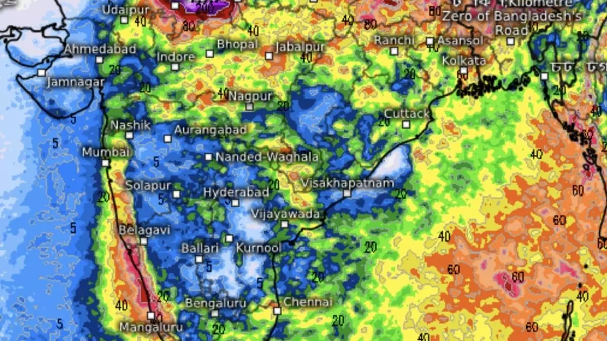
Monsoon Update: North-West, East & North-East India slip under heavy rains
The vertical offshore trough along the West Coast and the perpendicular monsoon trough from North-West India to the Bay of Bengal, though not evolved to the best of their ability, are facilitating full-fledged monsoon conditions over most parts of the country after the seasonal rain regime extended cover over the entire land almost a week early on July 2.
This is despite the Bay resembling a ghost town, devoid of major activity usually set off by a sustained low-pressure area. The monsoon has so far thrived mainly on its internal dynamics, with record-breaking land heating in April-May setting up suitable temperature and pressure gradients for moist winds to flow in from the Arabian Sea and the Bay. After all, they blow from an area of higher pressure (sea) to that of lower pressure (land).
Monsoon internal dynamics
Air over land heats up and ascends, to be replaced by monsoon winds from the Arabian Sea and the Bay. June braved anxious moments when rains seemed to stall on more than one occasion, leaving a deficit of 11 per cent, but a revival later that month and in early July has helped cut it down to four per cent as of Wednesday. As for the rest of July, the India Meteorological Department (IMD) has forecast normal to above-normal rain for most parts of the country.
Above-normal rainfall also poses potential risks of flooding, landslides, surface transport disruptions, public health challenges, and ecosystem damage. The IMD said it is essential to reinforce infrastructure, enhance surveillance and conservation efforts, and establish robust response systems in vulnerable sectors by utilising early warnings from the national forecaster.
Bay circulation seen
On Thursday, the monsoon trough lay extended from North-West Rajasthan via Orai, Churu, and Purulia, dipping in North-East Bay. This is an ideal situation where the south-eastern tip of the trough could help spin up a helpful sea-based circulation. The IMD projects the formation of one such over the next four days, which could help strengthen the trough and intensify rain over parts of North-West, Central and East India. Elsewhere, circulations located over land are aiding the monsoon regime.
Fairly widespread to widespread light to moderate rain, thunderstorms, and lightning are forecast for North-West and Central India during the next five days. Isolated heavy rain is expected for the Jammu Division, Himachal Pradesh, and Punjab on Friday, over Uttarakhand until Sunday, and Uttar Pradesh on both Friday and Saturday.
Heavy to very heavy rain
As for East and North-East India, fairly widespread to light to moderate rain, thunderstorms and lightning are forecast for the next five days. Isolated very heavy rain is likely over Bihar on Friday; over hills of West Bengal and Sikkim until Saturday; Arunachal Pradesh, Nagaland, Manipur, Mizoram and Tripura on Saturday; Assam & Meghalaya on both Saturday and Sunday; and Odisha on Sunday. Isolated, extremely heavy rain may pound Arunachal Pradesh, Assam and Meghalaya on Friday.
Along the West Coast, isolated heavy rain may lash Konkan & Goa on Sunday and Monday; East Gujarat on Friday; Kerala & Mahe until Tuesday; Coastal Andhra Pradesh & Yanam on Monday and Tuesday; Telangana on Sunday and Monday; Coastal Karnataka on Monday; and South Interior Karnataka on Friday and Monday. It will be isolated very heavy over Konkan & Goa until Saturday, over Madhya Maharashtra until Monday, Coastal Karnataka until Sunday, and South Interior Karnataka on Saturday and Sunday.
(E.o.m.)
