Monsoon enters Mumbai early, bides time to get going over Central India
Thiruvananthapuram
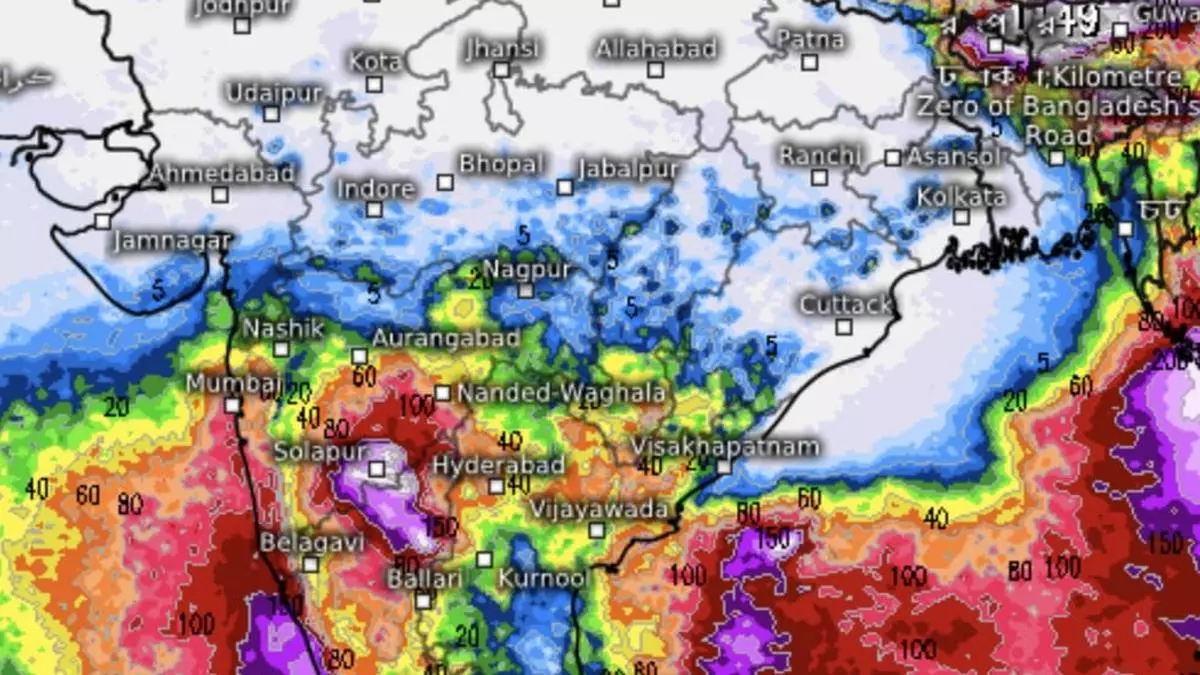
South-West monsoon entered Mumbai two days ahead of normal on June 9 (Sunday) but forecasts suggest it would beat around the bush along the West Coast and extreme East and North-East for another week and is not likely get a move into Central India thanks mainly to an unsupportive Bay of Bengal.
It badly needs a fresh circulation/low-pressure area in the Bay to get going into Central India where the Arabian Sea and the Bay arms meet before rains can extend to the whole country. Churned ahead of time by severe cyclone Remal, the Bay waters need more time to settle and set up next the next circulation. There is no sign of this happening for at least a week, per latest short-to-medium outlook.
Unfriendly winds
What Central and adjoining North-West India currently have are monsoon-unfriendly westerly to north-westerly winds, bringing into play the odd western disturbance to amplify pre-monsoon thunderstorms alternated by extreme heat. The winds have to turn decidedly south-easterly over this region to bring the monsoon. A narrow corridor may show up by June 20 along the foothills of the Himalayas, and likely reaching as far interior to the North-West as Delhi, to receive these winds.
It is yet to be seen if they would be able to bring the monsoon into the national capital where its normal date of arrival is around June 30. The European Centre for Medium-Range Weather Forecasts says the monsoon would be active along the West Coast and parts of the extreme East and North-East India till such time. Parts of South-East Peninsula including Tamil Nadu and Rayalaseema are also shown as benefitting to some extent during the intervening period (June 9 to 17).
Cyclonic circulations
India Meteorological Department (IMD) said the monsoon’s northern limit monsoon passes through Thane, Ahmednagar, Beed, Nizamabad, Sukma, Malkangiri, Vizianagaram and Islampur. The monsoonal playground in the upper levels represented by a shear zone of opposing wind regimes, lies to the North of Mumbai along the Palghar latitude. A cyclonic circulation lies over Marathwada in the lower levels. To the East, another circulation located over North-East Assam is causing a surge of strong south-westerly/southerly winds from Bay to the North-Eastern States.
Given this context, isolated extremely heavy falls are likely over South Konkan and Goa; South Madhya Maharashtra and Coastal Karnataka on Monday; and over North Interior Karnataka on both Monday and Tuesday. It will be fairly widespread to widespread light to moderate and accompanied by thunderstorms, lightning and gusty winds (30-40 km/hr) over Arunachal Pradesh; Assam & Meghalaya; Nagaland, Manipur, Mizoram & Tripura and hills of West Bengal and Sikkim during next seven days.
Isolated very rain likely
Isolated heavy rainfall is likely over the hills of West Bengal & Sikkim; Assam & Meghalaya and Arunachal Pradesh until Friday and over Nagaland from Wednesday to Friday. Isolated very heavy rainfall is likely over Assam & Meghalaya until Friday; over the hills of West Bengal & Sikkim until Wednesday and over Arunachal Pradesh from Wednesday to Friday.
Fairly widespread to widespread light to moderate rain, thunderstorms, lightning and gusty winds (40-50 km/hr) are likely over Konkan and Goa; Madhya Maharashtra; Marathwada; Karnataka; Kerala and Mahe; and Lakshadweep. It will be isolated light to moderate over Coastal Andhra Pradesh & Yanam; Rayalaseema; Telangana and Tamil Nadu, Puducherry & Karaikal during next 4-5 days.
Isolated heavy rainfall is likely over Konkan and Goa, Madhya Maharashtra, South Interior Karnataka and Kerala and Mahe until Wednesday and over Interior Karnataka until Friday. Isolated very heavy rain is likely over South Interior Karnataka on Monday and Tuesday and over North Interior Karnataka on Wednesday and Thursday.
