Monsoon likely to reach seas near Kerala in the next two days
South-West monsoon may enter some parts of the South-East Arabian Sea (off the Kerala coast); more parts of the Maldives, the Comorin area and the South Bay of Bengal; and some more parts of the Andaman & Nicobar Islands and the Andaman Sea by Thursday. India Meteorological Department (IMD) assessed conditions as favourable for its further advance in this manner over the seas that abut Lakshadweep and Sri Lanka, apart from Kerala, to the South-West of Peninsular India.
Monsoon over Lanka
Isolated heavy rain is likely over Tamil Nadu, Puducherry & Karaikal until Thursday; Kerala & Mahe on Friday. Isolated extremely heavy rain is likely over Kerala on Wednesday and Thursday. This will coincide with likely formation of a low-pressure area over the South-West Bay. Sri Lanka is experiencing rough seas and high winds, with winds being monsoon-friendly, westerly to south-westerly from Kalpitiya to Pottuvil via Colombo, Galle and Hambantota and clocking (40-50) km/hr in speed.
Cyclonic circulation
In an outlook valid until Wednesday afternoon, the Sri Lankan national forecaster said wind speeds may ratchet up to 60-70 km/hr at times, equivalent in intensity to that of a cyclone. They will speed up to 25-35 km/hr in other sea areas, peaking at 50 km/hr at times. Lanka is getting a whipping from a cyclonic circulation lying over North Kerala, which has since slipped out into the adjoining South-East Arabian Sea. Another circulation lay over the South-West Bay off the Chennai-Puducherry coast, which may deepen as a low-pressure area Wednesday. It may intensify into a depression over the Central Bay by Friday.
Likely deep depression
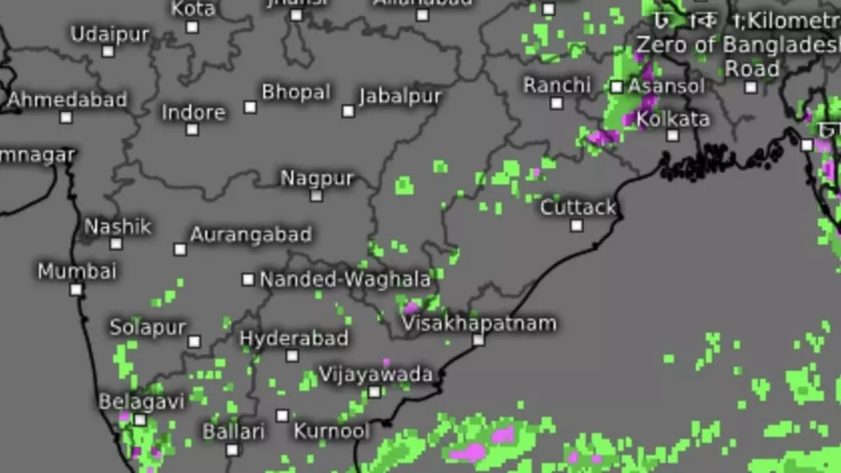
The IMD said it would continue to move northeastwards and intensify further. This would mean it could become a deep depression, only a step below tropical cyclone status, but not likely anything beyond. The deep depression may disintegrate due to its proximity to the rough terrain along the Myanmar coast. Satellite pictures on Tuesday afternoon showed rain-bearing clouds over the South-East Arabian Sea around Lakshadweep from Kavaratti to Minicoy. Thunderclouds hung heavy also over Chennai, Vellore, Kanchipuram, Ambur, Krishnagiri, Thiruvannamalai, Puducherry, Neyveli, Salem, Erode and Dharmapuri in Tamil Nadu.
Rain, thunderstorms
Fairly widespread to widespread light to moderate rain, thunderstorms, lightning, and gusty winds (it is still pre-monsoon over mainland India) is likely over Tamil Nadu, Puducherry & Karaikal; Kerala & Mahe; Lakshadweep; and Coastal & South Interior Karnataka for next five days. It will be isolated to scattered light to moderate along with thunderstorms, lightning and gusty winds over Coastal Andhra Pradesh & Yanam; Telangana; North Interior Karnataka; and Rayalaseema. Isolated heavy rain is likely over Coastal and South Interior Karnataka until Thursday; Lakshadweep, Tamil Nadu, Puducherry & Karaikal on Friday; and Kerala on Saturday.
